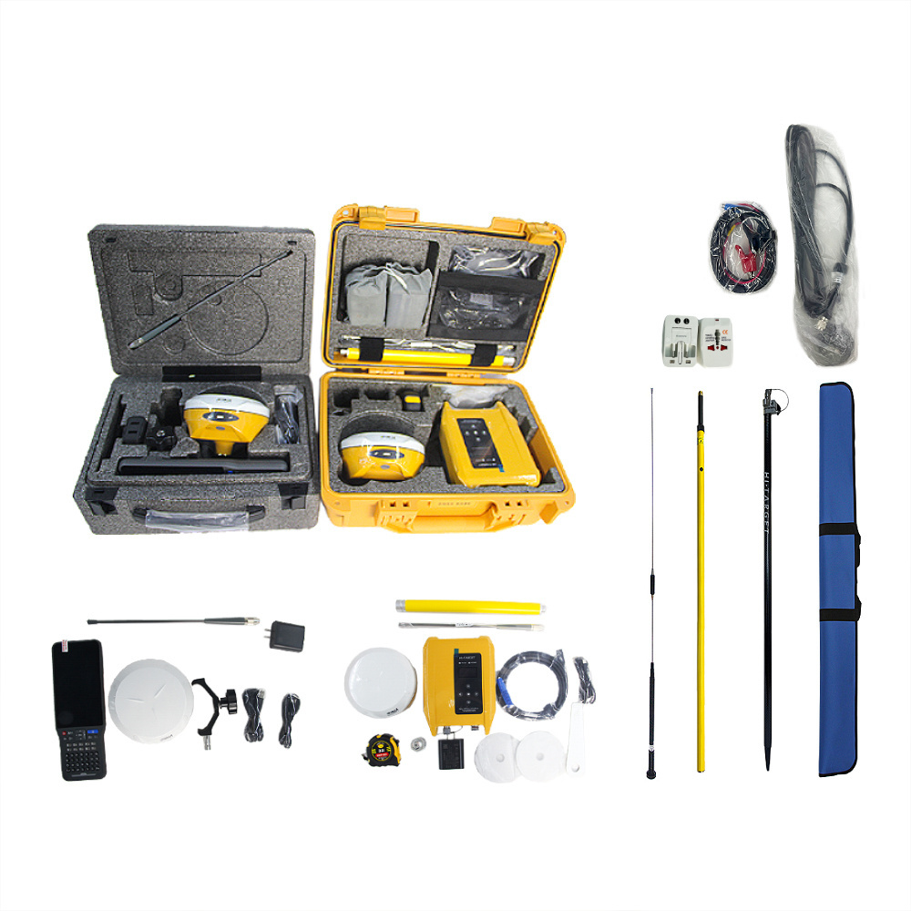
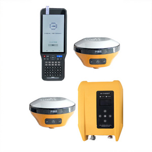
- Product Details
- {{item.text}}
Quick Details
-
Channels:
-
1408 Channels
-
Display:
-
LCD
-
Transmitting power:
-
0.5W, 1W, 2W adjustable
-
Internal battery life:
-
Static 12hours
-
GPS:
-
L1C/A,L1C,L2P(Y),L2C,L5
-
Weight:
-
1.5kg
-
Transmitting speed:
-
9.6Kbps, 19.2Kbps
-
SBAS:
-
L1,L2,L5
-
BDS:
-
B1I,B2I,B3I,B1C,B2a,B2b
Quick Details
-
Place of Origin:
-
Jiangxi, China
-
Brand Name:
-
hi target
-
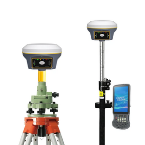
Product name:
-
Hi Target V300 GNSS RTK
-
Channels:
-
1408 Channels
-
Display:
-
LCD
-
Transmitting power:
-
0.5W, 1W, 2W adjustable
-
Internal battery life:
-
Static 12hours
-
GPS:
-
L1C/A,L1C,L2P(Y),L2C,L5
-
Weight:
-
1.5kg
-
Transmitting speed:
-
9.6Kbps, 19.2Kbps
-
SBAS:
-
L1,L2,L5
-
BDS:
-
B1I,B2I,B3I,B1C,B2a,B2b

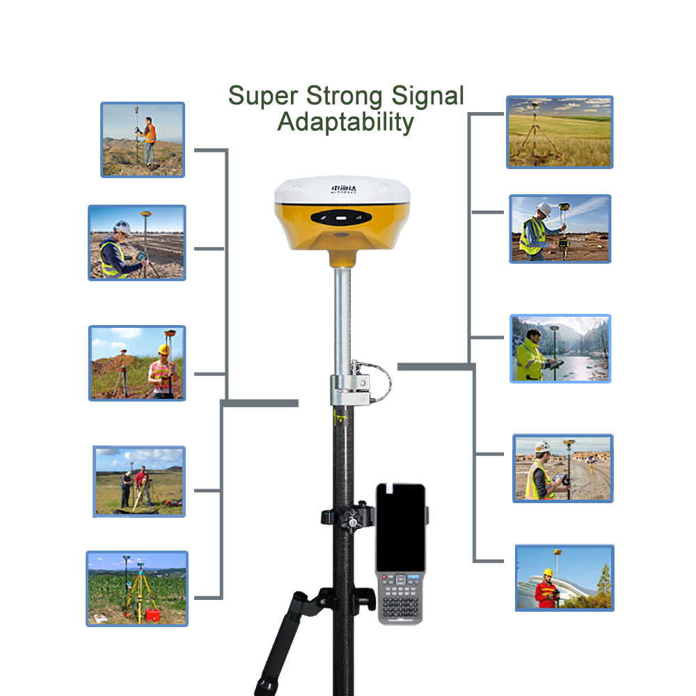
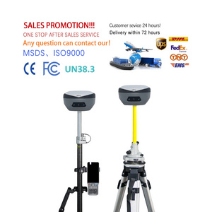
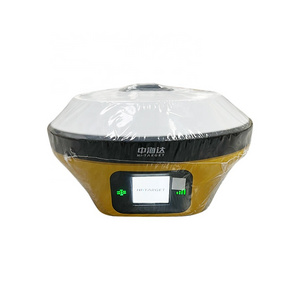
Original Hi-target Software Can Be Updated At Any Time


| GNSS configuration | Channel: 1408 | |
| Satellite tracking:BDS: B1I,B2I,B3I,B1C,B2a,B2b | ||
| GPS:L1C/A,L1C,L2P(Y),L2C,L5 | ||
| GLONASS: L1,L2 | ||
| GALILEO:E1,E5a,E5b,E6* | ||
| QZSS: L1,L2,L5,L6* | ||
| IRNSS:L5* | ||
| SBAS:L1,L2,L5 | ||
| L-BAND* | ||
| Output format | ASCII:NMEA-0183,Binary code | |
| Positioning output frequency | 1Hz~20Hz | |
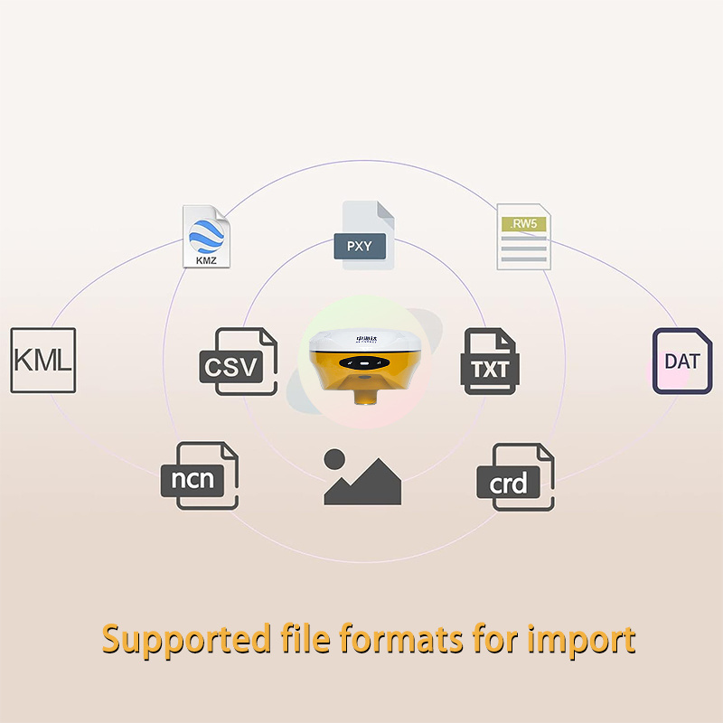
| Static data format | GNS, Rinex dual-format static data | |
| Difference scheme | RTCM2.X,RTCM3.X | |
| Network mode | VRS,FKP,MAC; Supports the NTRIP protocol | |
| System configuration | Operating system | Linux Operating system |
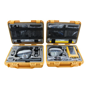
| Data storage | Built-in 16GB ROM, support static data automatic cycle storage | |
| Accuracy and reliability | RTK positioning accuracy | Plane: ±(8+1×10⁻⁶Dmm(D is the distance between measured points) |
| Height: ±(15+1×10⁻⁶D)mm(D is the distance between measured points) | ||
| Static positioning accuracy | Plane: ±(2.5+0.5×10⁻⁶D)mm(D is the distance between measured points) | |
| Height: ±(5+0.5×10⁻⁶D)mm(D is the distance between measured points) | ||
| Difference accuracy of satellite station | Plane accuracy: 10cm; Height accuracy: 20cm | |
| DGPS positioning accuracy | Plane accuracy: ±0.25m+1ppm; Elevation accuracy: ±0.50m+1ppm | |
| SBAS positioning accuracy | 0.5m | |
| Inclination measurement accuracy | 8mm+0.7mm/°tilt | |
| Image lofting accuracy | 1cm | |
| Initialization time | <10 seconds | |
| Initialization reliability | >99.99% | |
| Breakpoint continuation | RTK measurements are still available during differential signal outages | |
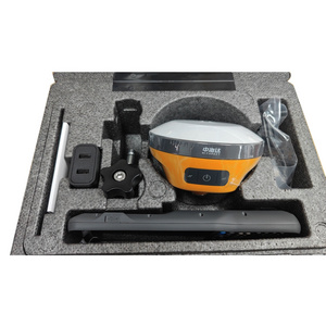
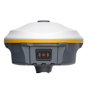
| Camera | function | Professional star night vision HD camera, large viewing Angle, support real scene lofting |
| Communication unit | I/0 port | USB Type-C port, SMA port |
| Cellular mobility | eSIM card: Support host and manual double eSIM, double network double standby, including 3 years of traffic, boot is high precision | |
| Built-in 4G network communication: TDD-LTE,FDD-LTE,WCDMA,TD-SCDMA,EDGE,GPRS,GSM | ||
| WiFi communication | 802.11a /b/g/n access point and client mode to provide WiFi hotspot services | |
| Bluetooth communication | Bluetooth® 2.4GHz, BT5.2 | |
| Built-in full protocol radio | Transceiver integration: base station transmission and mobile station reception | |
| Power: 0.5W/1W/2W adjustable | ||
| Frequency band: 410MHz to 470MHz | ||
| Protocol: HI-TARGET,TRIMTALK450S,TRIMMARKⅢ,TRANSEOT,SATEL | ||
| Number of channels: 116(16 of which are configurable) | ||
| Sensor | Electronic bubbles: Intelligent alignment | |
| Tilt measurement: Built-in a new generation of high-precision inertial navigation, automatic startup initialization, automatic attitude compensation | ||
| User interface | Button: Single button | |
| LED prompt light: satellite light, signal light, power light | ||
| Functional application | Advanced functions: NFC flash link, WebUI interaction, USB flash drive firmware upgrade | |
| Intelligent application: intelligent voice, function self-test | ||
| Remote service: message push, online upgrade, remote control | ||
| Cloud services: Device management, location services, collaborative work, data analytics | ||
| Physical characteristics | Host battery: high capacity lithium battery 6800mAh, working time is better than 16 hours | |
| External power supply: USB 15W charging | ||
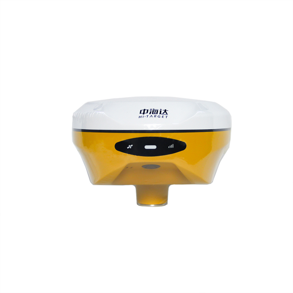
| Size: Φ130mm×68mm | ||
| Environmental characteristics | Dustproof and waterproof: IP68 | |
| Anti-fall: Resist the natural fall of 2 meters high measuring pole | ||
| Relative humidity: 100% non-condensing | ||
| Operating temperature: -45℃~+75℃ | ||
| Storage temperature: -55℃~+85℃ | ||
Hot Searches
