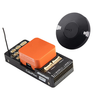
- Product Details
- {{item.text}}
Quick Details
-
Application:
-
UAV
-
Type:
-
Autopilot
-
Series:
-
Multi-Function
-
Features:
-
Open Source
-
Mounting Type:
-
Desktop or embedded
-
Description:
-
Advanced Open Source Multi-Function Programmable
-
Weight:
-
120 g
-
Attitude:
-
Pitch 0.1°/±90°,Roll 0.1°/±180°,Course 0.3°/±180°
-
Angular:
-
±300°/s
-
Acceleration:
-
±2g / ±8g
-
Altitude:
-
-1000m~11000m
-
Airspeed:
-
0~300km/hr or 0~500km/hr
-
GPS System:
-
GPS, GLONASS, BeiDou, Galileo
-
Route:
-
100
-
Waypoint:
-
1000 / route
-
Set:
-
23 parameters / 18 action
Quick Details
-
Place of Origin:
-
China
-
Brand Name:
-
BMP
-
Model Number:
-
CCA42
-
Application:
-
UAV
-
Type:
-
Autopilot
-
Series:
-
Multi-Function
-
Features:
-
Open Source
-
Mounting Type:
-
Desktop or embedded
-
Description:
-
Advanced Open Source Multi-Function Programmable
-
Weight:
-
120 g
-
Attitude:
-
Pitch 0.1°/±90°,Roll 0.1°/±180°,Course 0.3°/±180°
-
Angular:
-
±300°/s
-
Acceleration:
-
±2g / ±8g
-
Altitude:
-
-1000m~11000m
-
Airspeed:
-
0~300km/hr or 0~500km/hr
-
GPS System:
-
GPS, GLONASS, BeiDou, Galileo
-
Route:
-
100
-
Waypoint:
-
1000 / route
-
Set:
-
23 parameters / 18 action
Specification
|
Physical |
I / O |
||
|
size |
:115x65x23mm |
PWM output |
: 6 channel |
|
weight |
:120g |
PPM output |
:12 channel |
|
Electrical |
PPM input |
:18 channel |
|
|
Voltage |
:DC 4V~18V |
Interface |
|
|
Current |
:220mA@6V |
Sin input |
:1 (18 channel) |
|
Power |
:1.32W |
Sout output |
:1 (12 channel) |
|
Accuracy |
CAN |
:1 (16 channel) |
|
|
Attitude |
: Pitch 0.1°/±90°,Roll 0.1°/±180°,Course 0.3°/±180° |
RS232-1 |
:PC / Digital Radio |
|
Position |
:2.5m |
RS232-2 |
:RTK / LiDAR / Simulation |
|
Range |
Voltage survey |
:2 (0~30V) |
|
|
Angular |
: ±300°/s |
RPM survey |
:2 |
|
Acceleration |
: ±2g / ±8g |
Route/WP |
|
|
Altitude |
: -1000m~11000m |
Route |
:100 |
|
Airspeed |
: 0~300km/hr or 0~500km/hr |
Waypoint |
:1000 / route |
|
GPS |
Set |
:23 parameters / 18 action |
|
|
Type |
: Ublox MAX-M8Q |
Online Map |
|
|
System |
: GPS, GLONASS, BeiDou, Galileo |
|
:Road, Hybrid, Satellite, Terrain Map |
|
Rate |
: 10Hz |
Open |
:Open Street Map |
|
Environment |
Data Recorder |
||
|
Temperature |
:-25°C~+70°C |
Capacity |
:8G / USB / High Speed / External |


