- Product Details
- {{item.text}}
Quick Details
-
Product number:
-
GNSS Surveying System
-
Model 1:
-
R26
-
GNSS Performance:
-
Channels;GPS;GLONASS;Galileo;BeiDou;QZSS
-
Size (L x W x H):
-
5.5 in * 5.5 in * 3.5 in(140 mm*140 mm*88 mm)
-
Weight:
-
2.27 lb (1.03 kg)
-
Model 2:
-
Handheld LP80
-
CPU:
-
8 cores 2.0GHz
-
Operating system:
-
Android 8.1
-
RAM:
-
4GB
-
Display size/type:
-
5 inch IPS highlight screen
Quick Details
-
Warranty:
-
12 months
-
Place of Origin:
-
China
-
Brand Name:
-
SMAJAYU
-
Product number:
-
GNSS Surveying System
-
Model 1:
-
R26
-
GNSS Performance:
-
Channels;GPS;GLONASS;Galileo;BeiDou;QZSS
-
Size (L x W x H):
-
5.5 in * 5.5 in * 3.5 in(140 mm*140 mm*88 mm)
-
Weight:
-
2.27 lb (1.03 kg)
-
Model 2:
-
Handheld LP80
-
CPU:
-
8 cores 2.0GHz
-
Operating system:
-
Android 8.1
-
RAM:
-
4GB
-
Display size/type:
-
5 inch IPS highlight screen
Specification
|
Model
|
R26 GNSS Receiver
|
|
|
|
|
Channels
|
432 channels based on Nebulas-Ⅱ
|
|
|
|
GPS
|
L1/L2/L5
|
|
|
|
GLONASS
|
L1, L2
|
|
|
|
Galileo
|
E1, E5a , E5b
|
|
|
|
BeiDou
|
B1I/B2I
|
|
|
|
QZSS
|
L1, L2, L5
|
|
|
|
Real time
kinematics(RTK) |
Horizontal: 8 mm + 1 ppm RMS
Vertical: 15 mm + 1 ppm RMS Initialization time:< 5 s Initialization reliability: > 99.9% |
|
|
|
Post-processing
kinematics (PPK) |
Horizontal: 2.5 mm + 1 ppm RMS
Vertical: 5 mm + 1 ppm RMS |
|
|
|
Post -processing
static |
Horizontal: 2.5 mm + 0.5 ppm RMS
Vertical: 5 mm + 0.5 ppm RMS |
|
|
|
Positioning rate
|
Default 1 HZ, Maximum 20 HZ
|
|
|
|
Time to first fix
|
Cold start: < 25 s
Hot start: < 10 s Signal re-acquisition: < 1 s |
|
|
|
RTK tilt - compensated
|
Tilt angle 0~60°, Tilt accuracy 25mm
(within 30° accuracy) |
|
|
|
Size (L x W x H)
|
140 mm x 140 mm x 88 mm
(5.5 in × 5.5 in × 3.5 in) |
|
|
|
Weight
|
1.03 kg (2.27 lb)
|
|
|
|
Environment
|
Operating: -45°C to +75°C
(-49°F to +167°F) Storage: -55°C to +85°C (-67°F to +185°F) |
|
|
|
Humidity
|
100% condensation
|
|
|
|
Ingress protection
|
IP67 waterproof and dustproof,
protected from temporary immersionto depth of 2 m |
|
|
|
Shock
|
Survive a 2-meter pole drop
|
|
|
|
Tilt sensor
|
Calibration - free IMU for pole - tilt
compensation. Immuneto magnetic disturbances. |
|
|
|
Front panel
|
4 LED indicates
2 physical buttons |
|
|
Communication
|
Blue-tooth
|
v 4.0, Backward compatible with BT2.x
|
|
|
|
Ports
|
1 x 9 PIN aviation plug, including power
supply, COM RS232, CONFIG,RS232. 1 x UHF radio antenna interface |
|
|
|
Build-in UHF radio
|
Standard Internal Rx/Tx:
410 - 470 MHz/840MHz Transmit Power: 0.5 W to 2 W Protocol: Transparent, TT450S,Trimtalk, TRMMARK3, SOUTH, SATEL |
|
|
|
External Radio
|
Frequency: 410-470MHz
Transmitting power: 35W Working Range: 15-20Km |
|
|
|
Data formats
|
Link rate: 9600 bps to 460800 bps
Range: Typical 5 km to 8 km RTCM2.x, RTCM3.x, CMR |
|
|
|
Data storage
|
8 GB internal memory
|
|
|
Electrical
|
Power consumption
|
5 W (depending on user settings)
|
|
|
|
Li -ion battery capacity
|
10200mAh
|
|
|
|
Operating time on
internal battery |
20h(Rover)
10h(Base) |
|
|
|
External power input
|
9 V DC to 36 V DC
|
|
|
|
Power consumption
|
As Rover<4.0W
As Base<10.5W |
|
|
Model
|
Handheld LP80
|
|
CPU
|
8 cores 2.0GHz
|
|
Operating system
|
Android 8.1
|
|
RAM
|
4GB
|
|
Display size/type
|
5 inch IPS highlight screen
|
|
Camera
|
Rear 13 million auto-focus camera; high-brightness LED flash
Front 5 million fixed focus camera |
|
Resolution
|
720*1280
|
|
Touch screen
|
5-point capacitive touch screen
|
|
Dimension
|
207*84*20mm
|
|
Weight (including battery)
|
360g
|
|
Battery capacity
|
7000mAh
|
|
Charging method
|
PE fast charge, fully charged within 4 hours
|
|
Blue-tooth
|
BT4.1 BLE
|
|
GPS
|
GPS+BD+GLONASS
|
|
Data communication
|
FDD-LTE B1/B3/B5/B7/B8
TDD-LTE B38/B39/B40/B41 TDSCDMA B34/B39 WCDMA B1/B2/B5/B8 GSM B2/B3/B5/B8 CDMA1x/CDMA2000 BC0/BC1 |
|
Audio
|
Front dual stereo speakers, volume 90db±3db (test distance 10cm)
|
|
Sensor
|
Geomagnetism, acceleration, light sensing distance
|
|
Expansion card slot
|
Expandable up to 128G memory card
|
|
External interface
|
USB-TypeC, support fast charge, support OTG, Bottom charging contacts for cradle charging
|
|
Button
|
30 keys + 2 volume keys + 1 power key
|
|
method to informe
|
Sound, vibration, LED prompt
|
|
Operating temperature
|
20℃ + 55℃
|
|
storage temperature
|
-30℃ + 70℃
|
|
Working humidity
|
Humidity 5% to 95%
|
|
Certification and test report
|
CCC、CTA、CE
|
|
Fall
|
6 sides can withstand the impact of falling to the concrete floor from a height of 1.5 meters
|
|
Static Protection
|
±15kV air discharge, ±8kV contact discharge
|
|
PSAM card (smart encryption card)
|
optional
|
|
RFID (High Frequency)
|
Supported protocols: ISO14443A/B, ISO15693, NFC Reading distance: 0~5cm
|
Products Description
R26 Surveying System Rover+Base
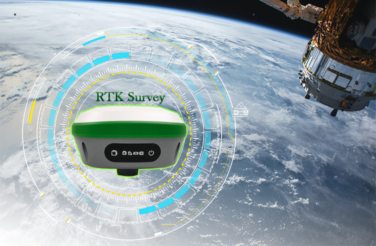
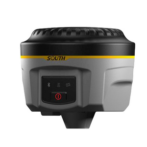
R26 integrated Beidou/GNSS receiver is a built-in large-capacity battery, large-capacity memory card, integrated multi-functional high-precision inertial navigation RTK receiver independently developed by SMAJAYU, built-in Beidou/GNSS full-frequency antenna, and multiple frequency points in the whole system High-precision positioning and orientation boards, Bluetooth, inertial navigation, radio and other modules.


Product packaging
Hot Searches


