
- Product Details
- {{item.text}}
Quick Details
-
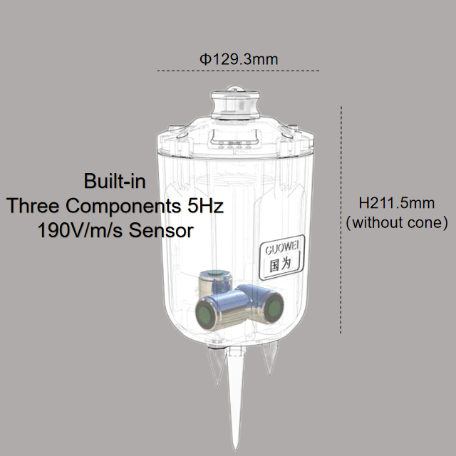
Model Number:
-
UGL-3C
-
Power:
-
elec
-
Material:
-
metal
-
Size:
-
129.5*211.5mm
-
Channels:
-
3-Channels
-
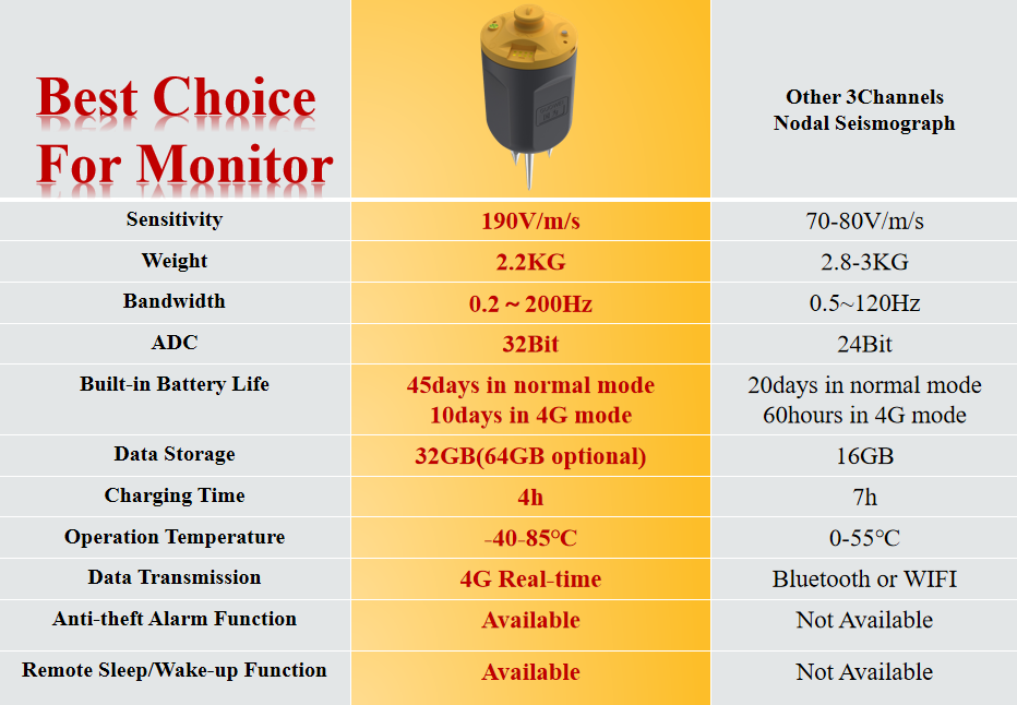
Sensitivity:
-
190V/m/s
-
Natural Frequency:
-
5HZ
-
Bandwidth:
-
0.2Hz~200Hz
-
Waterproof:
-
IP68
-
Noise Level:
-
0.11μV RMS
-
Method:
-
MASW/SASW/SPAC/HVSR
-
Function:
-
4G Real-time/WIFI/Bluetooth
-
Weight:
-
<2.2kg(with battery without cone)
-
Temperature range:
-
-40℃-85℃
Quick Details
-
Warranty:
-
1 years
-
Place of Origin:
-
Anhui, China
-
Brand Name:
-
Guowei
-
Model Number:
-
UGL-3C
-
Power:
-
elec
-
Material:
-
metal
-
Size:
-
129.5*211.5mm
-
Channels:
-
3-Channels
-
Sensitivity:
-
190V/m/s
-
Natural Frequency:
-
5HZ
-
Bandwidth:
-
0.2Hz~200Hz
-
Waterproof:
-
IP68
-
Noise Level:
-
0.11μV RMS
-
Method:
-
MASW/SASW/SPAC/HVSR
-
Function:
-
4G Real-time/WIFI/Bluetooth
-
Weight:
-
<2.2kg(with battery without cone)
-
Temperature range:
-
-40℃-85℃
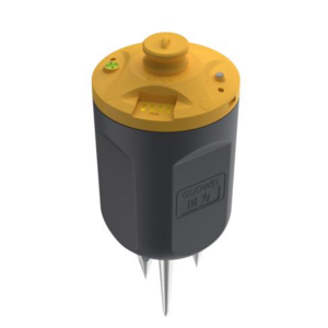
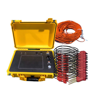
PRODUCT SPECIFICATIONS
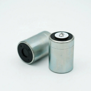
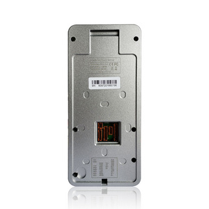
UGL-3C is a three-component, intelligent nodal seismograph designed by our company.
The main advantages of this product are 4G remote real-time transmission, high sensitivity sensor, compact and portable, which can realize intelligent data acquisition, transmission, download and distribution in real-time.
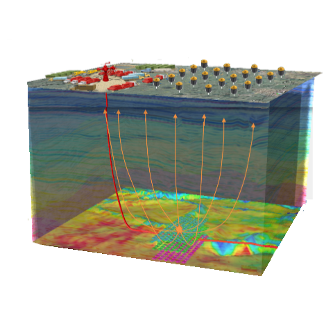
Widely used in real-time monitoring of geological disasters, long-term real-time monitoring of earthquakes and oil&gas, CCUS fracturing.
The main advantages of this product are 4G remote real-time transmission, high sensitivity sensor, compact and portable, which can realize intelligent data acquisition, transmission, download and distribution in real-time.
Widely used in real-time monitoring of geological disasters, long-term real-time monitoring of earthquakes and oil&gas, CCUS fracturing.
Comparison of Noise Spectral Density
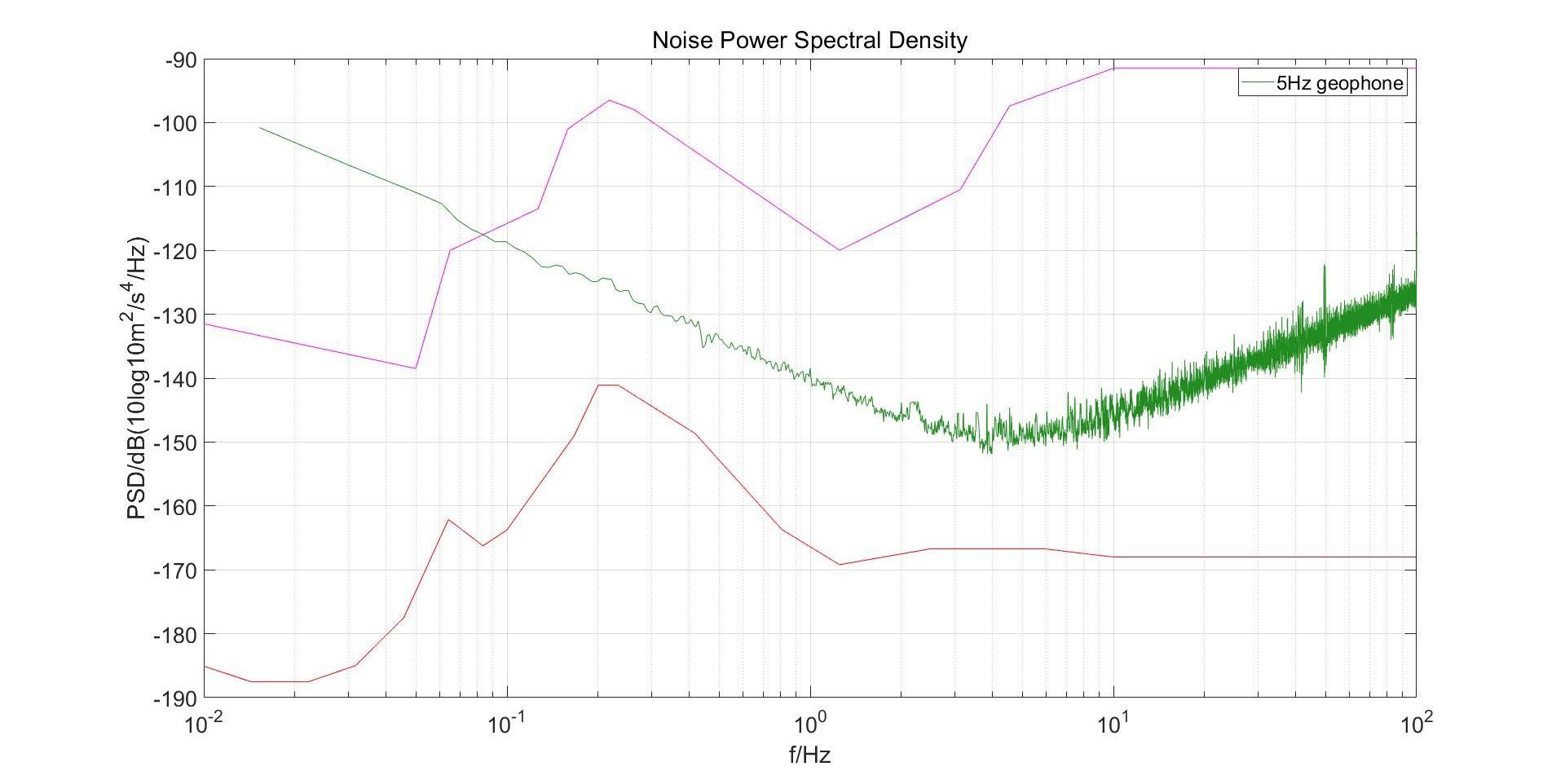
Origin of New High Noise Model and New Low Noise Model:
Peterson.J,1993,Observation and Modelling of background Seismic Noise,Open File Report,93-322,U.S.G.S

Practical Application for UGL-3C:
Urban und erground space, roadbed boulders, urban drainage pipelines, detection of engineering crack.
Foundation or subgrade survey for hollowing Division of rock formation and cover layer Rock formation division and disease
Geological body survey Re
search on the embedded depth, shape and distribution rule of the basal layer
2.Resources exploration:
Lithology mutation (aquifer), coal and oil and gas exploration, etc.
Lithology mutation (aquifer), coal and oil and gas exploration, etc.
Real time monitoring and warning of oil and gas fracturing, landslides, and road collapses.
Real time monitoring and imaging of oil and gas pressure cracking, CCUS carbon dioxide storage;
3.Structural exploration:
Karst, fault fracture zone, collapse column, goaf, real-time monitoring of overburden thickness.
Karst, fault fracture zone, collapse column, goaf, real-time monitoring of overburden thickness.
4.Real time monitoring:
Mobile real-time monitoring station of seismic bureau system;
Long term real-time monitoring of various micro seismic events;
Real time monitoring and warning of geological disasters, landslides, collapses, etc;
Research on real-time monitoring of micro earthquakes and real-time imaging of background noise
in universities and research institutes.
Long term real-time monitoring of various micro seismic events;
Real time monitoring and warning of geological disasters, landslides, collapses, etc;
Research on real-time monitoring of micro earthquakes and real-time imaging of background noise
in universities and research institutes.
5.Natural activities:
Monitoring of crustal and upper mantle plate activity.
Monitoring of crustal and upper mantle plate activity.
Dense array, background noise imaging, geothermal energy,active faults, real-time monitoring of strategic mineral
exploration, scientific research and seismological research.
exploration, scientific research and seismological research.
Software Introduction
4G Real-time Remote Monitoring
3D Processing Software
Micro Seismic Monitor Software
Hot Searches
