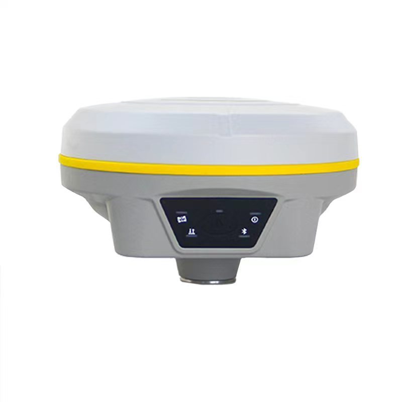

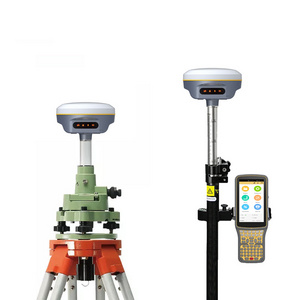
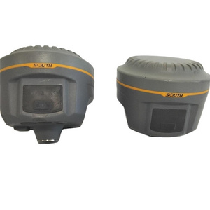
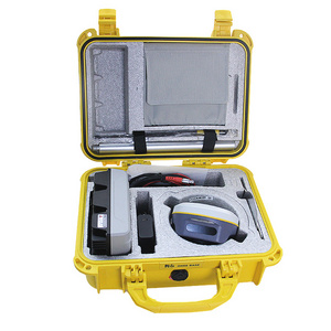
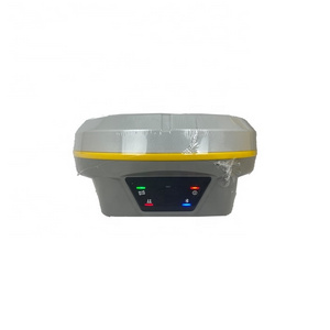
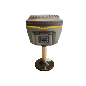
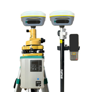
- Product Details
- {{item.text}}
Quick Details
-
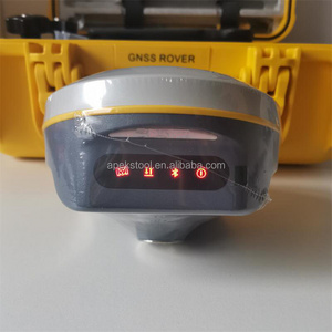
Display:
-
LCD
-
Channels:
-
1598 Channels
-
Transmitting power:
-
0.5W, 1W, 2W adjustable
-
GPS:
-
L1, L1C, L2C, L2P, L5
-
Internal battery life:
-
Static 12hours
-
Weight:
-
1.5kg
-
GLONASS:
-
L1C/A,L1P,L2C/A,L2P,L3*
-
Application:
-
Land Surveying
-
Transmitting speed:
-
9.6Kbps, 19.2Kbps
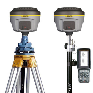
Quick Details
-
Place of Origin:
-
Jiangxi, China
-
Brand Name:
-
OEM
-
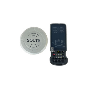
Product name:
-
GPS RTK
-
Display:
-
LCD
-
Channels:
-
1598 Channels
-
Transmitting power:
-
0.5W, 1W, 2W adjustable
-
GPS:
-
L1, L1C, L2C, L2P, L5
-
Internal battery life:
-
Static 12hours
-
Weight:
-
1.5kg
-
GLONASS:
-
L1C/A,L1P,L2C/A,L2P,L3*
-
Application:
-
Land Surveying
-
Transmitting speed:
-
9.6Kbps, 19.2Kbps


| GNSS Features | Channels | 1598 |
| GPS | L1, L1C, L2C, L2P, L5 | |
| GLONASS | L1C/A,L1P,L2C/A,L2P,L3* | |
| BDS | BDS-2: B1I, B2I, B3I | |
| BDS-3: B1I, B3I, B1C, B2a, B2b* | ||
| GALILEOS | E1, E5A, E5B, E6C, AltBOC* | |
| SBAS(WAAS/MSAS/EGNOS/GAGAN) | L1* | |
| IRNSS | L5* | |
| QZSS | L1, L2C, L5* | |
| MSS L-Band | BDS-PPP | |
| Positioning output rate | 1Hz~20Hz | |
| Initialization time | < 10s | |
| Initialization reliability | > 99.99% | |
| Positioning Precision | Code differential GNSS positioning | Horizontal: 0.25 m + 1 ppm RMS |
| Vertical: 0.50 m + 1 ppm RMS | ||
| Static(long observations) | Horizontal: 2.5 mm + 1 ppm RMS | |
| Vertical: 3 mm + 0.4 ppm RMS | ||
| Static | Horizontal: 2.5 mm + 0.5 ppm RMS | |
| Vertical: 3.5 mm + 0.5 ppm RMS | ||
| Rapid static | Horizontal: 2.5 mm + 0.5 ppm RMS | |
| Vertical: 5 mm + 0.5 ppm RMS | ||
| PPK | Horizontal: 3 mm + 1 ppm RMS | |
| Vertical: 5 mm + 1 ppm RMS | ||
| RTK(UHF) | Horizontal: 8 mm + 1 ppm RMS | |
| Vertical: 15 mm + 1 ppm RMS | ||
| RTK(NTRIP) | Horizontal: 8 mm + 0.5 ppm RMS | |
| Vertical: 15 mm + 0.5 ppm RMS | ||
| RTK initialization time | 2 ~ 8s | |
| SBAS positioning | Typically < 5m 3DRMS | |
| BANDA-L | Horizontal: 5-10cm (5-30min) | |
| Vertical: 10-30cm (5-30min) | ||
| IMU | Less than 10mm + 0.7 mm/° tilt to 30° | |
| IMU tilt angle | 0° ~ 60° | |
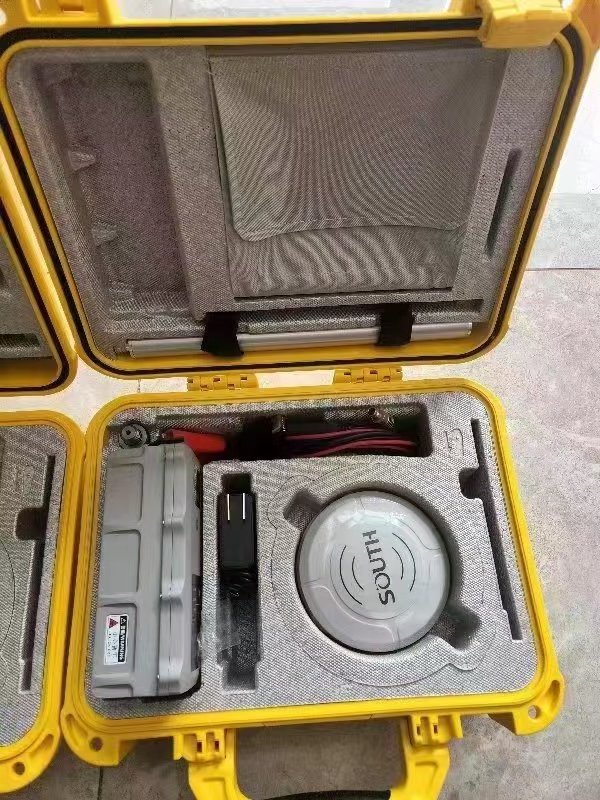
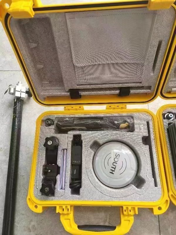
| Hardware Performance | Dimension | 130mm(W) ×130mm(L) × 80mm(H) |
| Weight | 790g (battery included) | |
| Material | Magnesium aluminum alloy shell | |
| Operating temperature | -45℃ ~ +75℃ | |
| Storage temperature | -55℃ ~ +85℃ | |
| Humidity | 100% Non-condensing | |
| Waterproof/Dustproof | IP68 standard, protected from long time immersion to depth of 1m IP68 standard, fully protected against | |
| blowing dust | ||
| Shock/Vibration | Withstand 2 meters pole drop onto the cement ground naturally | |
| MIL-STD 810G | ||
| Power supply | 6-28V DC, overvoltage protection | |
| Battery | Inbuilt 7.2V 6800mAh rechargeable, Li-ion battery | |
| Battery life | 15h (Rover Bluetooth mode) | |
| Communications | I/O Port | 5-PIN LEMO external power port + RS232 Type-C (charge, OTG to USB disk, data transfer with PC or phone, Ethernet) |
| 1 UHF antenna TNC interface | ||
| Internal UHF | 2W radio, receive and transmit, radio router and radio repeater | |
| Frequency range | 410 - 470MHz | |
| Communication protocol | Farlink, Trimtalk450s, SOUTH, HUACE, Hi-target, Satel | |
| Communication range | Typically 8km with Farlink protocol | |
| NFC Communication | Realizing close range (shorter than 10cm) automatic pair between receiver and controller (controller requires NFC wireless communication module else) | |
| Bluetooth | Bluetooth 3.0/4.1 standard, Bluetooth 2.1 + EDR | |
| WIFI | Modem | 802.11 b/g standard |
| WIFI hotspot | AP mode, Receiver broadcasts its hotspot form web UI accessing with any mobile terminals | |
| WIFI datalink | Client mode, Receiver can transmit and receive correction data stream via WiFi datalink | |
| Data Storage/Transmission | Storage | 4GB SSD Automatic cycle storage (The earliest data files will be removed automatically while the memory is not enough) |
| Support external USB storage | ||
| Data transmission | Plug and play mode of USB data transmission | |
| Supports FTP/HTTP data download | ||
| Data format | Static data format: STH, Rinex2.01, Rinex3.02 and etc. | |
| Differential format: RTCM 2.3, RTCM 3.0, RTCM 3.1, RTCM 3.2 | ||
| GPS output data format: NMEA 0183, PJK plane coordinate, SOUTH Binary code | ||
| Network model support: VRS, FKP, MAC, fully support NTRIP protocol | ||
| Sensors | Electronic bubble | Controller software can display electronic bubble, checking leveling status of the carbon pole in real-time |
| IMU | Built-in IMU module, calibration-free and immue to magnetic interference | |
| Thermometer | Built-in thermometer sensor, adopting intelligent temperature control technology, monitoring and adjusting the receiver temperature | |
| User Interaction | Operating system | Linux |
| Buttons | One button | |
| Indicators | 5 LED indicators(Satellite, Charging, Power, Datalink, Bluetooth) | |
| Web interaction | With the access of the internal web interface management via WiFi or USB connection, users are able to monitor the receiver status and change the configurations freely | |
| Voice guidance | It provides status and operation voice guidance, and supports Chinese/English/Korean/Spanish/Portuguese/Russian/Turkish | |
| Secondary development | Provides secondary development kit, and opens the OpenSIC observation data format and interaction interface definition | |
| Cloud service | The powerful cloud platform provides online services like remote manage, firmware update, online register and etc. |

Hot Searches
