- Product Details
- {{item.text}}
Quick Details
-
point positioning(RMS):
-
plane: 1.5m, elevation:3.0m
-
DGPS(RMS):
-
plane: 0.4m, elevation: 0.8m
-
RTK(RMS):
-
plane: 1cm+1ppm, elevation:1.5cm+1ppm
-
data format:
-
NMEA-0183, Unicore*
-
data update frequency:
-
20Hz
-
time accuracy (RMS):
-
20ns
-
speed accuracy (RMS):
-
0.03m/s
-
Application:
-
surveying equipment, mobile mapping
Quick Details
-
Warranty:
-
6 months
-
Place of Origin:
-
Tianjin, China
-
Brand Name:
-
Foxtech
-
point positioning(RMS):
-
plane: 1.5m, elevation:3.0m
-
DGPS(RMS):
-
plane: 0.4m, elevation: 0.8m
-
RTK(RMS):
-
plane: 1cm+1ppm, elevation:1.5cm+1ppm
-
data format:
-
NMEA-0183, Unicore*
-
data update frequency:
-
20Hz
-
time accuracy (RMS):
-
20ns
-
speed accuracy (RMS):
-
0.03m/s
-
Application:
-
surveying equipment, mobile mapping
Details Images


Note: Please leave a note when ordering to tell us which country/region are you in since the 4G module of S-RTK100 will be different. Pay attention to the power bank specification requirements, if there is no qualified power bank available around, please contact us before you make an order.
Highlights:
No Need For Outdoor Closed-loop
No Need For Outdoor Control Points
High-precision Positioning
Simple & Portable
Multiple Working Modes
4G/Bluetooth Transmission
No Need For Outdoor Closed-loop
No Need For Outdoor Control Points
High-precision Positioning
Simple & Portable
Multiple Working Modes
4G/Bluetooth Transmission
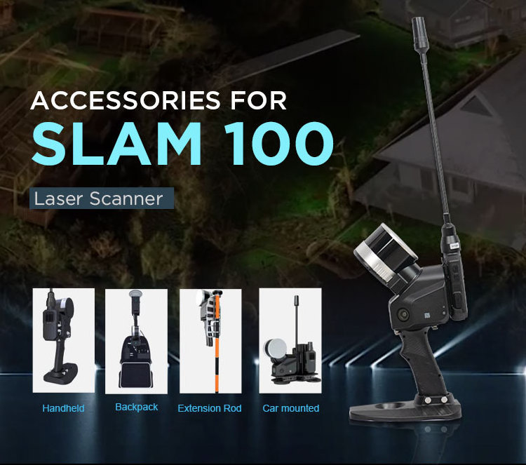
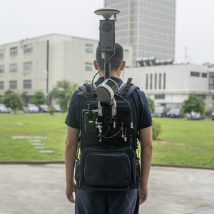
The S-RTK100 can be used with SLAM100 mounting on S-PACK100 backpack, or used alone as a mobile RTK device, providing flexible applications and high-accuracy positioning data acquisition.
S-RTK100 supports
4G communication
so that users can obtain data stably. High-level protection design, good
waterproof and dust-proof
performance, small size and lightweight make S-RTK100 easy to carry, easy to set up and use. SLAM100 working combined with S-RTK100 will no longer need control points and closed-loop routes in wide open spaces, so the scanning process becomes easier and faster.
S-PACK100
provides a platform where S-RTK100, SLAM100 and external battery can be mounted together, which largely improves SLAM100 working efficiency. Hands free S-PACK100 weighs 3.65 kg without SLAM100 or power banks, and its size is 330*240*555mm. The power bank suitable for S-PACK100 should have a power output higher than 45 W, a 20 V output voltage, and supports PD protocol. There are four places prepared for power banks inside the backpack.
|
point positioning(RMS)
|
plane: 1.5m, elevation:3.0m
|
|
DGPS(RMS)
|
plane: 0.4m, elevation: 0.8m
|
|
RTK(RMS)
|
plane: 1cm+1ppm, elevation:1.5cm+1ppm
|
|
data format
|
NMEA-0183, Unicore*
|
|
data update frequency
|
20Hz
|
|
time accuracy (RMS)
|
20ns
|
|
speed accuracy (RMS)
|
0.03m/s
|
|
Application
|
surveying equipment, mobile mapping
|
Hot Searches


