- Product Details
- {{item.text}}
Quick Details
-
Laser Scanning FOV:
-
270°x360°
-
Relative Accuracy:
-
2cm
-
Absolute Accuracy:
-
5cm
-
Battery Duration:
-
2.5h
-
IP Rating:
-
IP 54
-
Operating Temperature:
-
-10℃~+45℃
-
Laser Channels:
-
16 beams
-
Maximum Range:
-
120m
-
Camera Resolution:
-
5 Megapixels
-
Application:
-
obtain high-precision 3D point cloud data
Quick Details
-
Type:
-
Handheld 3D Scanner
-
Scan Element Type:
-
/
-
Place of Origin:
-
China
-
Laser Scanning FOV:
-
270°x360°
-
Relative Accuracy:
-
2cm
-
Absolute Accuracy:
-
5cm
-
Battery Duration:
-
2.5h
-
IP Rating:
-
IP 54
-
Operating Temperature:
-
-10℃~+45℃
-
Laser Channels:
-
16 beams
-
Maximum Range:
-
120m
-
Camera Resolution:
-
5 Megapixels
-
Application:
-
obtain high-precision 3D point cloud data

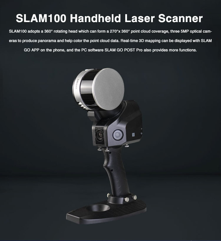
SLAM100 Handheld LiDAR Scanner
has a 360°rotating head, which can form a 270°x360° point cloud coverage. Combined with the industry-level SLAM algorithm, it can obtain high-precision three-dimensional point cloud data of the surrounding environment even without light and GPS signal.
Three 5MP cameras
are adopted to form a horizontal 200°FOV and a vertical 100°FOV, which can synchronously obtain texture information and to furthermore produce color point clouds and partial panoramic images.
SLAM100 adopts an integrated structure design with a built-in control and storage system and built-in replaceable lithium batteries. It supports
one-key-start
, making data acquisition more efficient and convenient.
SLAM100 can create digital terrain (DTM) and digital elevation models (DEMs) of specific landscapes, and is widely used in various applications such as traditional surveying and mapping, enclosed space, 3D digitization, emergency response and so on due to its portability and GPS-free.
Features:
·360°rotating
·Industry-level SLAM Algorithm
·Three 5MP Visible Light Cameras
·Real-time SLAM mapping
·Automatic Control Point Collect
·360°rotating
·Industry-level SLAM Algorithm
·Three 5MP Visible Light Cameras
·Real-time SLAM mapping
·Automatic Control Point Collect
This price is only for SLAM100 handheld lidar scanner.
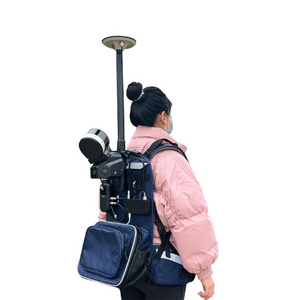
SLAM100 with S-RTK100 portable RTK module and S-PACK100 LiDAR backpack can provide a much easier and faster acquisition experience. If you need RTK module and Backpack, welcome to contact our sales staff anytime!
SLAM100 with S-RTK100 portable RTK module and S-PACK100 LiDAR backpack can provide a much easier and faster acquisition experience. If you need RTK module and Backpack, welcome to contact our sales staff anytime!
|
Laser Scanning FOV
|
270°x360°
|
|
Relative Accuracy
|
2cm
|
|
Absolute Accuracy
|
5cm
|
|
Battery Duration
|
2.5h
|
|
IP Rating
|
IP 54
|
|
Operating Temperature
|
-10℃~+45℃
|
|
Laser Channels
|
16 beams
|
|
Maximum Range
|
120m
|
|
Camera Resolution
|
5 Megapixels
|
|
Application
|
obtain high-precision 3D point cloud data
|


Customer Reviews
Customer Photos
Hot Searches


