- Product Details
- {{item.text}}
Quick Details
-
weight:
-
0.6KG
-
Size:
-
243mm(H) X 155mm(W) X 82mm(D)
Quick Details
-
Warranty:
-
12 Months
-
Place of Origin:
-
China
-
Color:
-
Black
-
weight:
-
0.6KG
-
Size:
-
243mm(H) X 155mm(W) X 82mm(D)
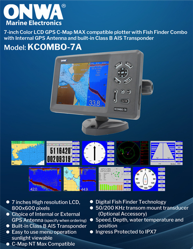
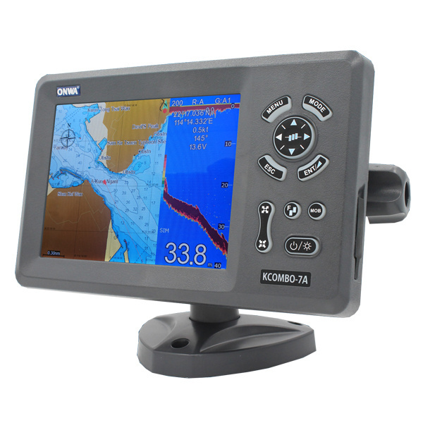
FEATURES:
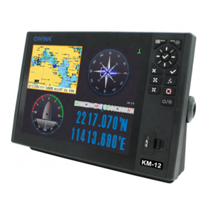
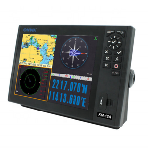
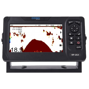
7″ Color LCD GPS C-Map MAX compatible plotter with Fishfinder Combo with Internal GPS Antenna and built-in Class B AIS Transponder
- 7 inches High resolution LCD,640×480 pixels
- Choice of External or Internal GPS Antenna (Specify when ordering)
- Built-in Class B AIS Transponder
- Easy to use menu operation
- sunlight viewable
- C-Map NT Max Compatible
- Digital Fishfinder Technology
- 50/200 KHz transom mount transducer(Optional Accessory)
- Speed, Depth, water temperature and position
- Ingress Protected to IP67
* VHF Antenna Needed for the AIS transmission (not included, optional accessory (KA-156/KA-162-X ))
MODELS: (SPECIFY WHEN ORDERING)
KCombo-7A: 7-inch GPS Chart Plotter with built-in Fish Finder and Class B AIS Transponder and External GPS Antenna
KCombo-7A+: 7-inch GPS Chart Plotter with built-in Fish Finder and Class B AIS Transponder and Internal GPS Antenna
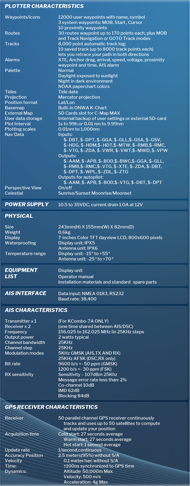
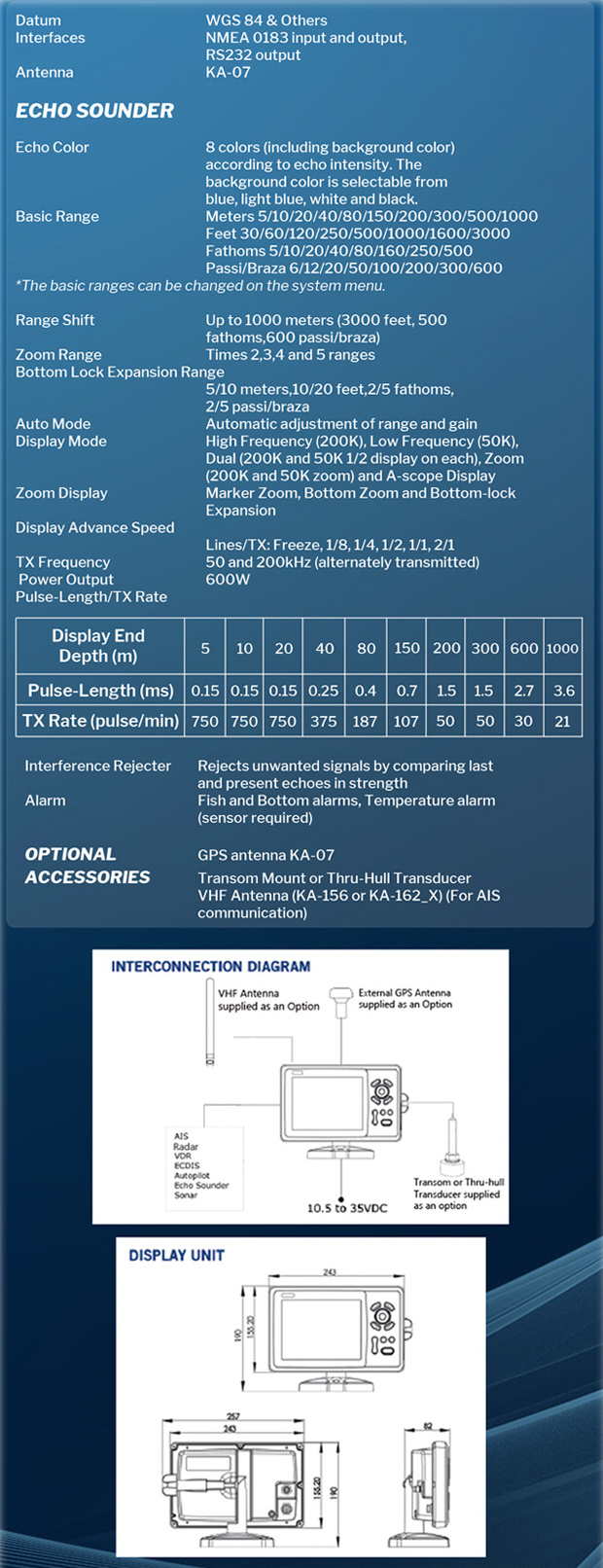
SPECIFICATIONS
PLOTTER CHARACTERISTICS |
|
| 1. Waypoints/icons |
12,000 user waypoints with name, symbol,
3 system waypoints: MOB,Start,cursor 10 proximity waypoints |
| 2. Routes | 30 routes waypoint up to 170 points each, plus MOB and Track Navigation or Goto Track modes |
| 3. Tracks | 8,000 point automatic track log; 10 saved track (up to 8000 track points each)let you retrace your path in both directions |
| 4. Alarms | XTE, Anchor drag, arrival, speed, voltage, proximity waypoint and time,AIS alarm. |
| 5. Pallete |
|
| 6. Tides | Tide data |
| 7. Projection | Mercator projection |
| 8. Position format | Lat/Lon |
| 9. Basemap | Built-in Onwa K-Chart |
| 10. External Map | SD Cards slot for C-Map MAX |
| 11. User data storage | Internal backup of user settings, or external SD-card |
| 12. Plot Interval | 1s to 99h or 0.01 nm to 9.99nm |
| 13. Plotting scales | 0.01nm to 1,000nm |
PHYSICAL |
|
| 1. Size | 243mm(H) X 155mm(W) X 82mm(D) |
| 2. Weight | 0.6kg |
| 3. Display | 7 inches Color TFT dayview LCD,800×600 pixels |
| 4. Waterproofing |
Display unit: IPX6
Antenna unit: IPX7 |
| 5. Temperature range | Display unit: -15℃ to +55℃ Antenna unit: -25℃ to +70℃ |
EQUIPMENT LIST |
|
| Standard |
|