- Product Details
- {{item.text}}
Quick Details
-
Channels:
-
336, 965 (optional)
-
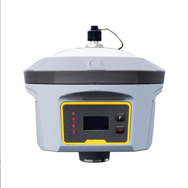
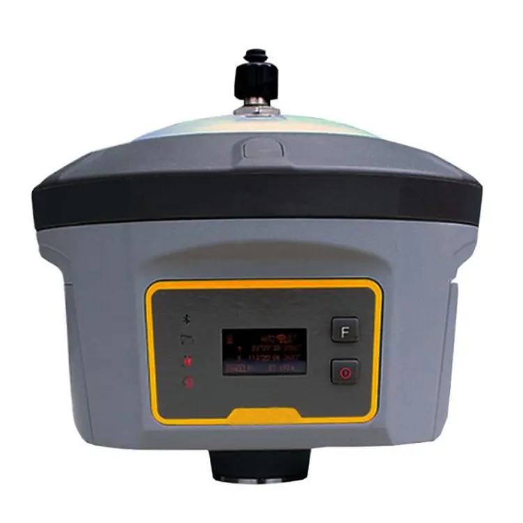
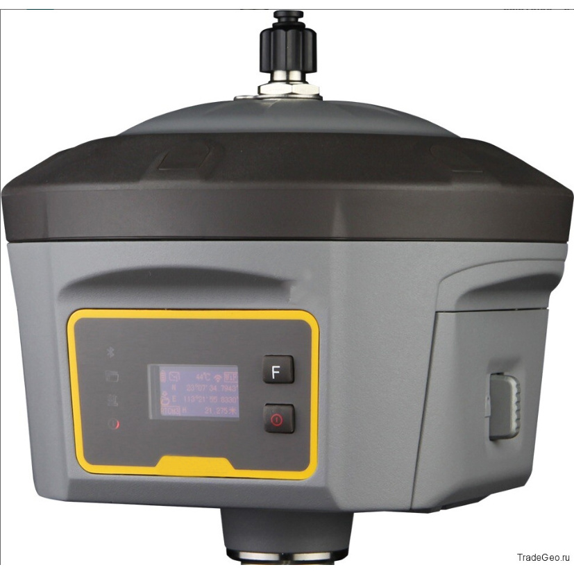
Display:
-
LCD
-
Transmitting power:
-
0.5W, 1W, 2W adjustable
-
Internal battery life:
-
Static 12hours
-
Supports:
-
WIFI
-
GPS:
-
L1C/A, L1C, L2C, L2E, L5
-
GLONASS:
-
L1C/A, L1P, L2C/A, L2P, L3
-
Transmitting speed:
-
9.6Kbps, 19.2Kbps
-
BDS:
-
B1, B2, B3
Quick Details
-
Place of Origin:
-
Jiangxi, China
-
Brand Name:
-
OEM
-
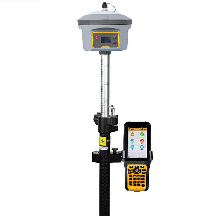
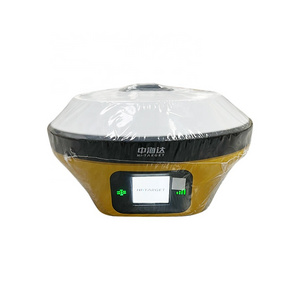
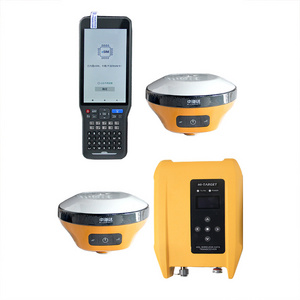
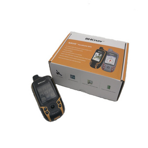
Product name:
-
G6 GPS RTK
-
Channels:
-
336, 965 (optional)
-
Display:
-
LCD
-
Transmitting power:
-
0.5W, 1W, 2W adjustable
-
Internal battery life:
-
Static 12hours
-
Supports:
-
WIFI
-
GPS:
-
L1C/A, L1C, L2C, L2E, L5
-
GLONASS:
-
L1C/A, L1P, L2C/A, L2P, L3
-
Transmitting speed:
-
9.6Kbps, 19.2Kbps
-
BDS:
-
B1, B2, B3

Original Software Can Be Updated At Any Time


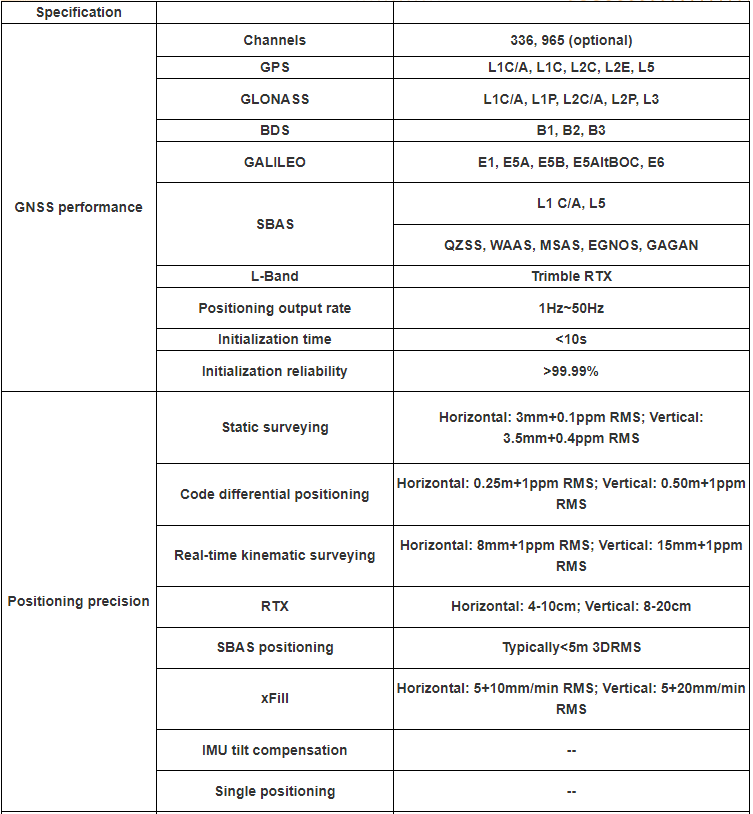
| Specification | ||
| GNSS performance | Channels | 336, 965 (optional) |
| GPS | L1C/A, L1C, L2C, L2E, L5 | |
| GLONASS | L1C/A, L1P, L2C/A, L2P, L3 | |
| BDS | B1, B2, B3 | |
| GALILEO | E1, E5A, E5B, E5AltBOC, E6 | |
| SBAS | L1 C/A, L5 | |
| QZSS, WAAS, MSAS, EGNOS, GAGAN | ||
| L-Band | Trimble RTX | |
| Positioning output rate | 1Hz~50Hz | |
| Initialization time | <10s | |
| Initialization reliability | >99.99% | |
| Positioning precision | Static surveying | Horizontal: 3mm+0.1ppm RMS; Vertical: 3.5mm+0.4ppm RMS |
| Code differential positioning | Horizontal: 0.25m+1ppm RMS; Vertical: 0.50m+1ppm RMS | |
| Real-time kinematic surveying | Horizontal: 8mm+1ppm RMS; Vertical: 15mm+1ppm RMS | |
| RTX | Horizontal: 4-10cm; Vertical: 8-20cm | |
| SBAS positioning | Typically<5m 3DRMS | |
| xFill | Horizontal: 5+10mm/min RMS; Vertical: 5+20mm/min RMS | |
| IMU tilt compensation | -- | |
| Single positioning | -- | |
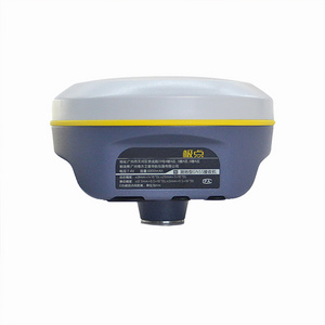
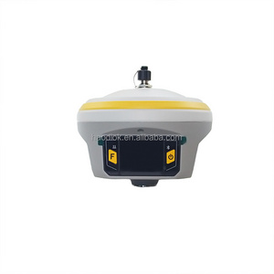
| User interaction | Operaing system | Linux |
| Buttons | Double buttons and visual operation interface | |
| LCD | 0.96 inch HD OLED screen, the resolution is 128 x 64 | |
| Indicators | -- | |
| Web UI | Accessing by WIFI or USB mode to monitor the receiver | |
| Voice guide | iVoice intelligent voice technology provides status and operation voice promptly, Supports Chinese, English, Korean, Russian, Portuguese, Spanish, Turkish | |
| Secondary development | Providing secondary development package, and opening the OpenSIC observation data format and interface definition for secondary development | |
| Data cloud service | Web page cloud service management platform, supporting online register etc | |
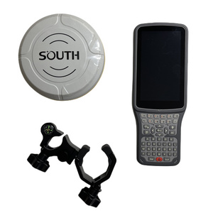
| Hardware performance | Dimension | 152mm (diameter) × 137mm (height) |
| Weight | 1.44kg (including battery) | |
| Material | Magnesium alloy shell | |
| Operating temperature | -40°C ~ +65°C | |
| Storag temperature | -55°C ~ +85°C | |
| Humidity | 100% Non-condensing | |
| Waterproof/Dustproof | IP67 standard, protected from long time immersion to depth of 1m, and fully protected against blowing dust | |
| Shock and vibration | MIL-STD-810G standard vibration test certified | |
| Power Supply | 9-25V wide voltage DC design, with overvoltage protection | |
| Battery | High capacity removable battery with the indicator displaying the power usage, 7.4V, 6800mAh/per | |
| Battery solution | (Providing the 7 × 24h battery solution) | |
| Battery life | More than 30h (static mode), More than 15h (RTK mode) | |
| Communications | I/O port | 5-PIN LEMO port, 7-PIN USB port (OTG), 1 network/radio data link antenna port, SIM card slot |
| Wireless modem | Integrated internal radio receiver and transmitter 1W/2W/3W | |
| Frequency Range | 403-473MHz | |
| Communication Protocol | Trimtalk450S, SOUTH, SOUTH+, SOUTHx, huace, ZHD, Satel | |
| Cellular Mobile Network | TDD-LTE, FDD-LTE 4G network modem | |
| Double Module | BLE 4.0 standard, 2.1 + EDR standard | |
| NFC Communication | Realizing close range (shorter than 10cm) automatic pair between receiver and controller | |
| External Devices | -- | |
| WIFI | Standard | IEEE 802.11 b/g |
| WIFI Hotspot | Adopting the WIFI hot spot function, any smart terminals (controller, cellphone and PC) can connect to the receiver easily | |
| WIFI data link | The receiver can transmit and receive correction via WiFi | |
| Data storage/ Transmission | Data Storage | 8GB internal storage, supports external USB data storage, changeable record interval, supports up to 50Hz raw data collection |
| Data Transmission | USB data transmission, FTP download, HTTP download | |
| Data Format | Static data format: STH, Rinex2.x and Rinex3.x etc | |
| Differential data format: CMR+, CMRx, RTCM 2.1, RTCM 2.3, RTCM 3.0, RTCM 3.1, RTCM 3.2 | ||
| GPS output data format: NMEA 0183, PJK plane coordinates, binary code, Trimble GSOF | ||
| Network model support: VRS, FKP, MAC, supporting NTRIP protocol | ||
| Inertial sensing system | Tilt survey | Built-in tilt compensator, correcting coordinates automatically according to the tilt direction and angle of the centering rod |
| Electronic bubble | Controller software display electronic bubble, checking leveling status of the centering rod real time | |
| Thermometer | Built-in thermometer sensors, adopting intelligent temperature control tech nology, monitoring and adjusting the receiver temperature in real time |
Hot Searches
