
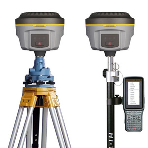
Suitable for building tunnels, buildings, bridges, settlement observations, topographic surveys, etc.
- Product Details
- {{item.text}}
Quick Details
-
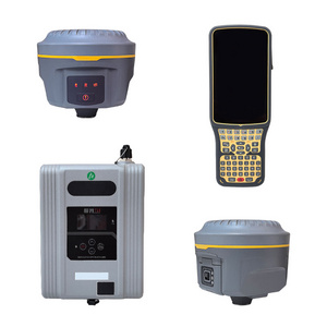
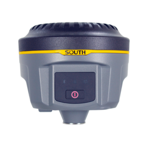
Product Name:
-
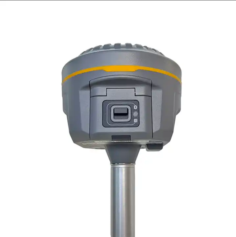
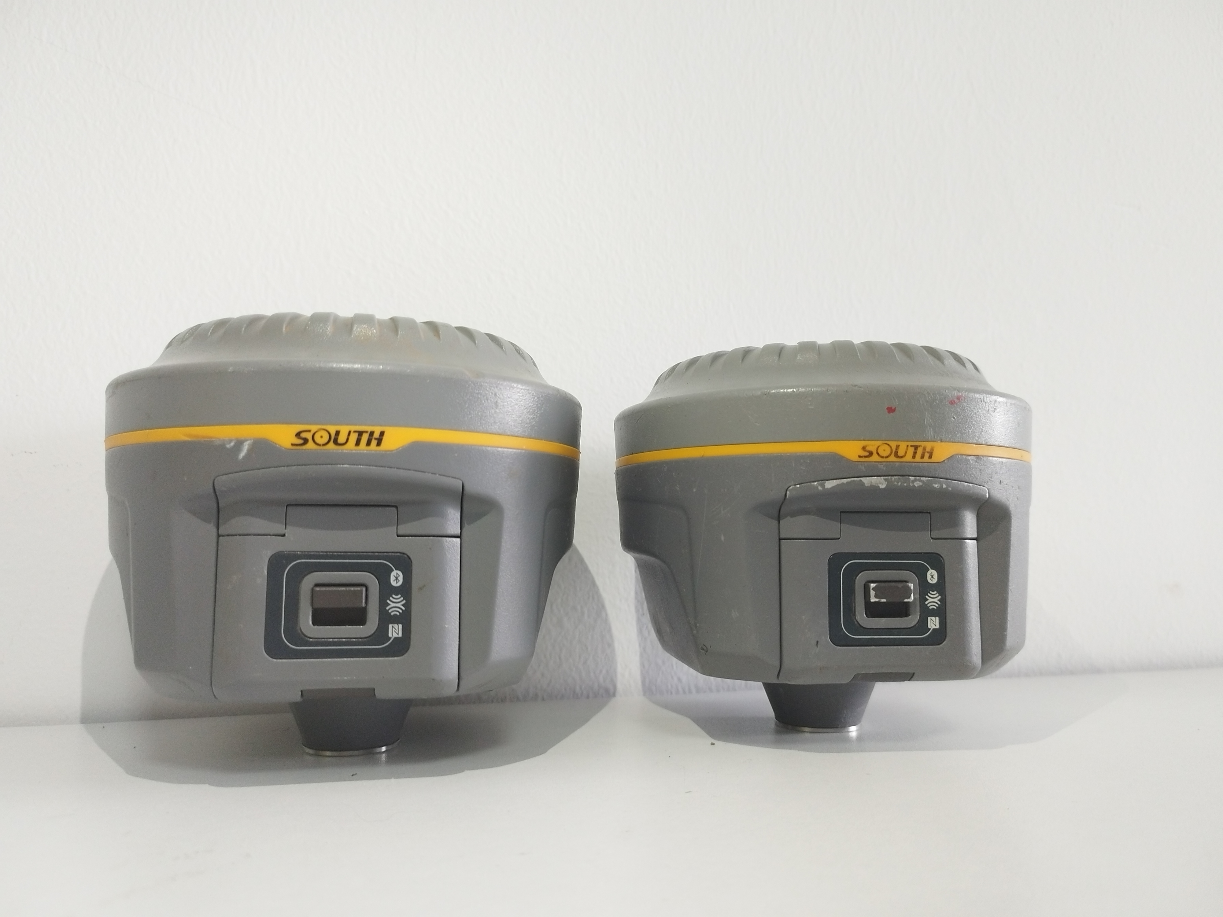
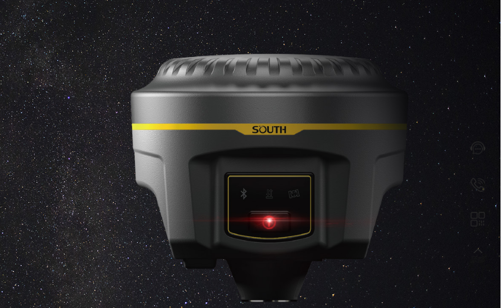
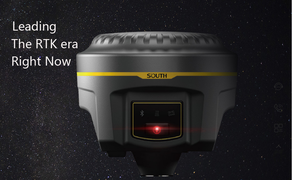
South G1
-
Transmitting Power:
-
0.5W, 1W, 2W adjustable
-
Frequency:
-
220 channels
-
GPS:
-
L1CA,L1P,L1C,L2P,L2C,L4
-
Display:
-
LCD
Quick Details
-
Warranty:
-
6 Months
-
Place of Origin:
-
Chongqing, China
-
Brand Name:
-
SOUTH
-
Product Name:
-
South G1
-
Transmitting Power:
-
0.5W, 1W, 2W adjustable
-
Frequency:
-
220 channels
-
GPS:
-
L1CA,L1P,L1C,L2P,L2C,L4
-
Display:
-
LCD
Products Introduction
Specification
|
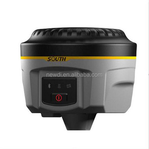
Galaxy G1
|
|
|
|
Surveying Performance
|
|
|
|
Channel
|
965 Channels
|
|
|
Signal Tracking |
BDS B1, B2, B3,
|
|
|
|
GPS L1C/A, L1C, L2C, L2E, L5
|
|
|
|
GLONASS L1C/A, L1P, L2C/A,L2P, L3
|
|
|
|
SBAS L1C/A, L5( Just for the satellites supporting L5 )
|
|
|
|
Galileo GIOVE-A, GIOVE-B, E1, E5A, E5B
|
|
|
|
QZSS,WAAS, MSAS, EGNOS, GAGAN, SBAS
|
|
|
GNSS Feature |
Positioning output rate: 1HZ~50HZ
|
|
|
|
Initialization time : <10s
|
|
|
|
Initialization reliability : >99.99%
|
|
|
Positioning Precision
|
|
|
|
Code Differential GNSS Positioning |
Horizontal: 0.25 m + 1 ppm
|
|
|
|
Vertical: 0.50 m + 1 ppm
|
|
|
|
SBAS positioning accuracy: typically<5m 3DRMS
|
|
|
Static GNSS Surveying |
Horizontal: 2.5 mm + 0.5 ppm
|
|
|
|
Vertical: 5 mm + 0.5 ppm
|
|
|
Real-Time Kinematic Surveying (Baseline<30km) |
Horizontal: 8 mm + 1 ppm
|
|
|
|
Vertical: 15 mm + 1 ppm
|
|
|
|
Horizontal: 8 mm + 0.5 ppm
|
|
|
|
Vertical: 15 mm + 0.5 ppm
|
|
|
Network RTK
|
RTK initialization time: 2~8s
|
|
|
Physical
|
|
|
|
Dimension
|
12.9cm × 11.2cm
|
|
|
Weigh
|
970g(includiing installed battery)
|
|
|
Material
|
Magnesium aluminum alloy shell
|
|
|
Environmental
|
|
|
|
Operating
|
-45℃~+60℃
|
|
|
Storage
|
-55℃~+85℃
|
|
|
Humidity
|
Non-condensing
|
|
|
Waterproof/Dustproof |
IP67 standard,protected from long time immersion to depth of 1m
|
|
|
|
IP67 standard,fully protected against blowing dust
|
|
|
Shock and Vibration |
Not operating: Withstand 2 meters pole drop onto the cement ground naturally
|
|
|
|
operating : Withstand 40G 10milliseconds sawtooth wave impact test
|
|
|
Electrical
|
|
|
|
Power consumption
|
2W
|
|
|
Battery
|
Rechargeable, removable Litium-ion battery
|
|
|
Battery Life
|
Single battery: 7h( static mode ) 5h( interual UHF base mode )
|
|
|
|
6h( rover mode )
|
|
|
Communications and Data storage
|
|
|
|
I/O Port |
5PIN LEOM external power port + RS232
|
|
|
|
7PIN LEOM RS232 + USB
|
|
|
|
1 network/radio data link antenna port
|
|
|
|
SIM card slot
|
|
|
Wireless Modem |
Integrated internal radio receiver and transmitter 0.5W/2W
|
|
|
|
External radio transmitter 5W/25W
|
|
|
Working frequency
|
410-470MHz
|
|
|
Communication protocol
|
TrimTalk450s, TrimMark3, PCC EOT, SOUTH
|
|
|
Cellular Mobile Network |
WCDMA3.5G network communication module, GPRS/EDGE compatible, CDMA2000/EVDO
|
|
|
|
3G optional
|
|
|
Double Module |
BLE 4.0 standard, support for android, ios cellphoon connection
|
|
|
|
+ EDR standard
|
|
|
NFC communication |
Realizing close range ( shorter than 10cm ) automatic pair between Galxy G1 and controller
|
|
|
|
(controller equipped NFC wireless communication module needed)
|
|
|
Data storage/Transmission |
4GB internal storage, more than 3 year raw observation data (1.4M/day) base on recording from 14 satelites Plug and play more of
USB data transmission |
|
|
Data Format
|
Differential data format: CMR+, CMRx, RTCM2.1, RTCM2.3, RTCM3.0, RTCM3.1, RTCM3.2
|
|
|
|
GPS output data format: NMEA0813, PJK plan, cordinates binary code
|
|
|
|
Network model support: various, FKP, MAC, supporting NTRIP protocol
|
|
|
Intertial Sensing System
|
|
|
|
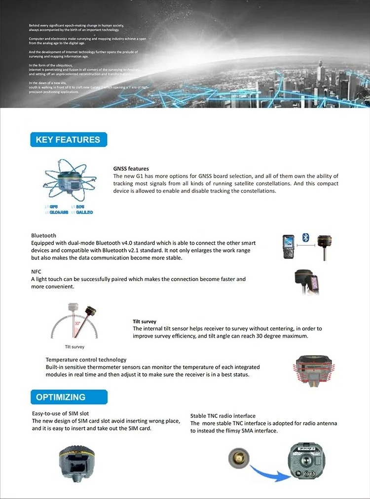
Tilt survey |
Built-in tilt compensator, correcting coordinates automaticlly according to the tilt direction and angle of the centering rod
|
|
|
Electornic Bubble
|
Conteroller software display electronic bubble, checking leveling status of the centering rod real time
|
|
|
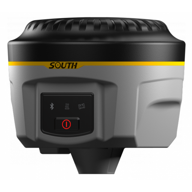
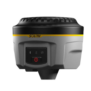
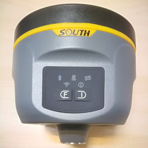
User Interaction
|
|
|
|
Buttons
|
One-button operation, Visual operation, convenient and efficient
|
|
Products Description
Application
Wide range of use scenarios
Our Advantages
About Us
We are based in Chongqing,China.A professional supplier of Total station, rtk GPS base and rover, Theodolite, Level, Surveying and mapping instrument accessories.
The main brands of the agent are: Topcon, Sokkia, Trimble, FOIF, South, Hi-target, etc. Any information you want to consult,please feel free to contact me.
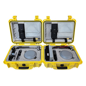
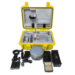
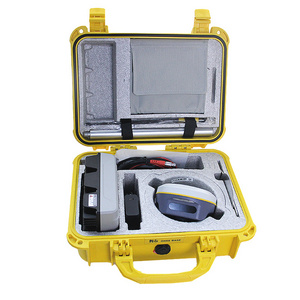
Packaging&Shipping
Customer Photos
Trust from customers all over the world
Our customers all over the world, our products after a long journey, through a variety of reliable transportation to the hands of customers and customers in a variety of construction conditions to maintain good performance and quality performance, please trust us, we will provide you with excellent chain service.
FAQ
1. Who are we?
We are based in Chongqing, China, start from 2018,sell to Domestic Market(00.00%). There are total about 11-50people in our office.
2. How can we guarantee quality?
Always a pre-production sample before mass production; Always final Inspection before shipment;
3.What can you buy from us?
We are the largest surveying and mapping instrument agent in southwest China.
The main brands of the agent are: Topcon, Sokkia, Trimble, FOIF, South, Hi-target, etc.
Main products are: total station,rtk GPS, level, theodolite, etc.
4. Why should you buy from us not from other suppliers?
Product diversification Servicediversification Lower price Quality control facilitation We provide our customers with the world's most cost-effective instrumentproducts,provide one-stop instrument solutions, quality products and services.
5. What services can we provide?
Accepted Delivery Terms: FOB;
Accepted Payment Currency:USD;
Accepted Payment Type: T/T,Western Union;
Language Spoken:All
Hot Searches
