
- Product Details
- {{item.text}}
Quick Details
-
RTK Accuracy:
-
H:8mm+1ppm;V:15mm+1ppm
-
Static Accuracy:
-
H:2.5mm+1ppm; V:5mm+1ppm
-
Tracked Signals:
-
GPS/Glonass/Beidou/Galileo/Sbas/QZSS/IRNSS
-
Channels:
-
394
-
Radio Frequency:
-
410~470MHz
-
Communication Way:
-
USB/BT/WI-FI/WebUI/4G/UHF Radio
-
Working range:
-
up to 15 KM with big radio
-
Internal Memory:
-
Internal 8GB, TF Extended Max 32G
-
Instrument Weight:
-
1.2KGS with 2 batteries inside
-
Instrument Size:
-
157mm*76mm
Quick Details
-
Warranty:
-
12 months
-
Place of Origin:
-
Guangdong, China
-
Brand Name:
-
Geodex
-
RTK Accuracy:
-
H:8mm+1ppm;V:15mm+1ppm
-
Static Accuracy:
-
H:2.5mm+1ppm; V:5mm+1ppm
-
Tracked Signals:
-
GPS/Glonass/Beidou/Galileo/Sbas/QZSS/IRNSS
-
Channels:
-
394
-
Radio Frequency:
-
410~470MHz
-
Communication Way:
-
USB/BT/WI-FI/WebUI/4G/UHF Radio
-
Working range:
-
up to 15 KM with big radio
-
Internal Memory:
-
Internal 8GB, TF Extended Max 32G
-
Instrument Weight:
-
1.2KGS with 2 batteries inside
-
Instrument Size:
-
157mm*76mm

Products Description


Features&Benefit
● Visual LED screen and voice assistance guide your field operation quickly.
● Multi one-button operations. Auto base setup by one button without controller.
● Standard Rinex data and raw data recorded at the same time.
● Quick upgrade by USB
Specification
|
Channel
|
394 Channels
|
|
SATELLITES
|
GPS:L1C/A,L1P,L1C,L2P,L2C,L5
GLONASS: L1 C/A, L2C, L2P L3, L5 BeiDou:B1,B2,B3 GALILEO:E1, E5a, E5b, E5 Altboc, E6 QZSS:L1 C/A, L1C, L2C, L5, L6 IRNSS: L5 SBAS:L1, L5 |
|
Update rate
|
5Hz(Standard to 5Hz,can pay to activate 50HZ)
|
|
Static Accuracy
|
Horizon: 2.5mm+1ppm; Vertical: 5mm+1ppm
|
|
RTK Accuracy
|
Horizon: 8mm+1ppm; Vertical: 15mm+1ppm
|
|
CODE Differential
|
Horizontal: 0.25m RMS, Vertical: 0.45 RMS
|
|
SABS Positioning
|
Horizontal: 0.3m RMS, Vertical: 0.6m RMS
|
|
Tilt Survey Sensor
|
IMU
(Optional) |
|
Battery
|
Dual Batteries, 7.2V/6800mAh
Over 13 hours when simultaneous use of 2 batteries |
|
Input
|
9~28V DC
|
|
OS
|
*Based on Linux; Supports Web UI, Multi-language supported
|
|
Operation
|
*RTK rover/base, post-processing RTK Network rover: VRS, FKP, MAC Point-to-Point GPRS through Real-time Data Server Software
(internal GPRS or external cell phone) Land XML (Surpad 4.0 RTK Field Software) Total Station Support (Surpad 4.0 RTK Field Software) Import and stake directly from a DXF File ( Surpad 4.0) |
|
Memory
|
Internal 8G: TF Extended, Max≥32G
|
|
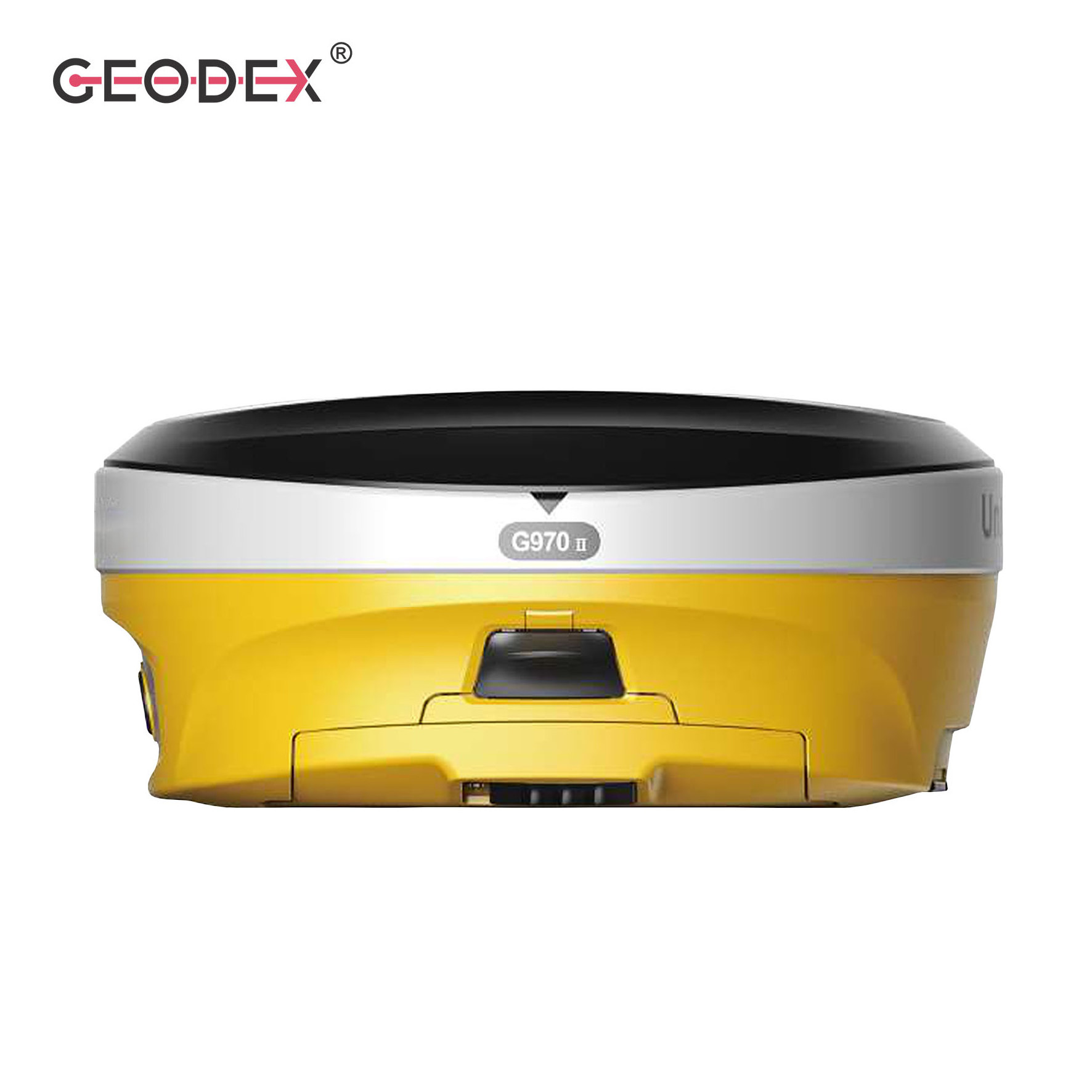
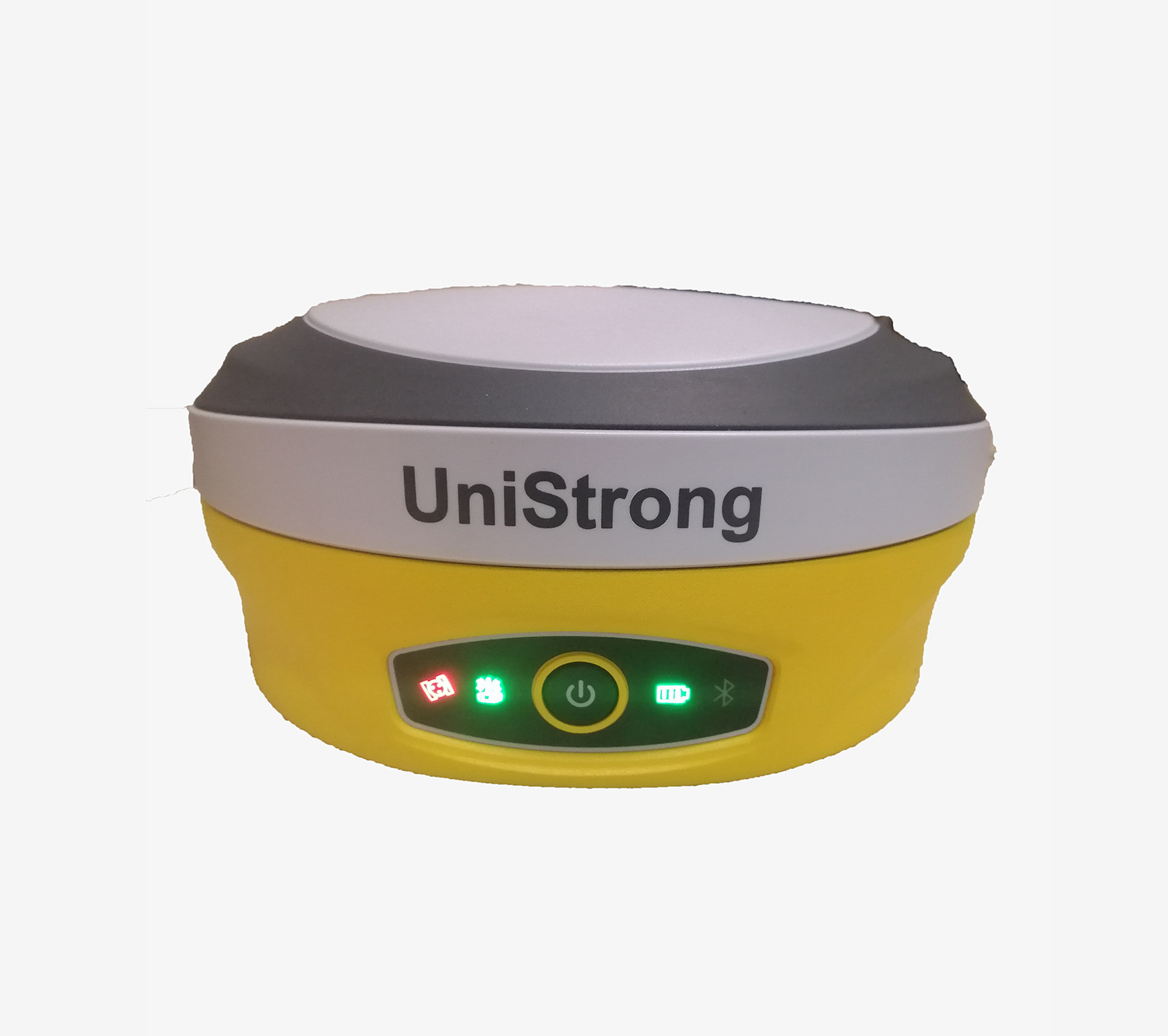
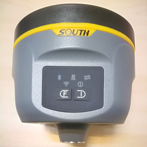
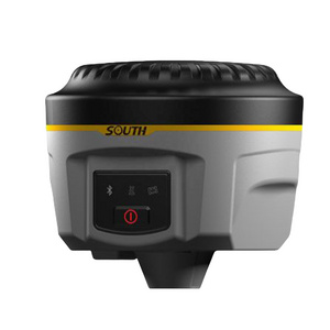
Button
|
Power button,also can show Power status
|
|
Indicator
|
5 indicators:Satellites,Datalink,Bluetooth,WIFI Status,Power Indicator
|
|
Language
|
Supports TTS Multi language voice
|
|
I/O Connectors
& Interface |
7-pins Lemo-USB Port,NMEA Out put;
5-pins Lemo interfaces (For external radio and external power); Multifunction cable with USB interface for PC connection Micro SIM Slot and TF slot |
|
Bluetooth
|
V2.1+EDR、V4.1 Dual Mode,Class2
|
|
WI-FI
|
802.11 b/g/n
|
|
Web UI
|
To upgrade the software, manage the status and settings, data download, etc. Via smart phone, tablet or other internet enabled
electronic device |
|
4G Band
|
GSM/GPRS/EDGE, FDD LTE:B2/B4/B12
UMTS/WCDMA:B2/B4/B5 |
|
Internal
UHF |
Type: Tx-Rx; TNC interface port; Frequency 410-470MHz
Work Distance:3-4KM in good environment |
|
External Radio (Relay Radio)
|
Frequency: 410-470MHz; Channel spacing: 12.5KHz/25KHz
Work Range: up to 10KM |
|
Protocol
|
SATEL,PCC-GMSK,TrimTalk
450S, South, TrimMark III(19200), GeoTalk, GeoMark |
|
Output
Data Formats |
RTCM 2.1, 2.3, 3.0, 3.1, 3.2, 3.3
CMR CMR+ RTCA NOVATELX |
|
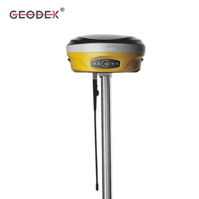
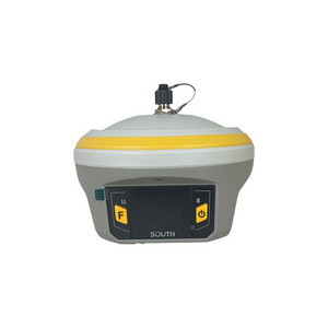
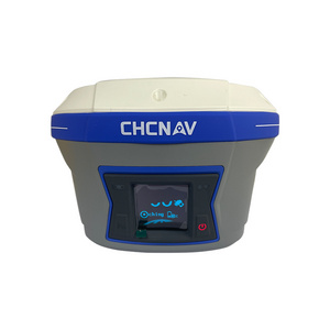
Instrument Size: D*H
|
157mm*76mm
|
|
Weight
|
1.2KGS with 2 batteries inside
|
|
Work Temperature
|
-30℃ ~ + 65℃
|
|
Stock
Temperature |
-40℃ ~ +80℃
|
|
Water/dustproof
|
IP68
|
|
Anti-Shock
|
Withstand 2 meters pole drop, 1.2m drop without pole
|
|
Humidity
|
100% condending
|
Packing & Delivery
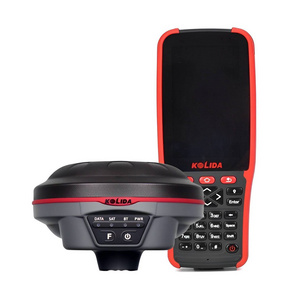
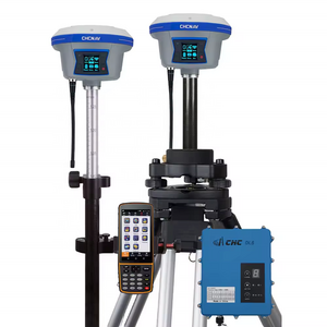
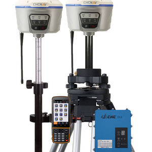
1. Customer can select the RTK GNSS either base kit with external radio or rover kit with data controller.
2. And both rover kit w + base kit (1+1) as specific needs.
Recommend Products
More Products

Hot Searches
