- Product Details
- {{item.text}}
Quick Details
-
Full-featured radio:
-
410-470MHZ
-
Electronic bubble:
-
support
-
manage platform:
-
WebUI
-
network:
-
4G/3G/2G/Cors
-
Operating Temperature:
-
-40°C to +75°C
-
Storage Temperature:
-
-50°C to +85°C
-
Size:
-
Dia.190mm x 100mm
-
Weight:
-
1.1 KG
Quick Details
-
Place of Origin:
-
China
-
Brand Name:
-
South
-
Channels:
-
440 Channels
-
Full-featured radio:
-
410-470MHZ
-
Electronic bubble:
-
support
-
manage platform:
-
WebUI
-
network:
-
4G/3G/2G/Cors
-
Operating Temperature:
-
-40°C to +75°C
-
Storage Temperature:
-
-50°C to +85°C
-
Size:
-
Dia.190mm x 100mm
-
Weight:
-
1.1 KG
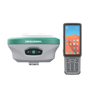
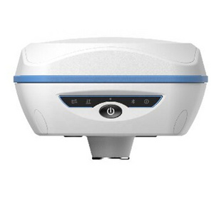
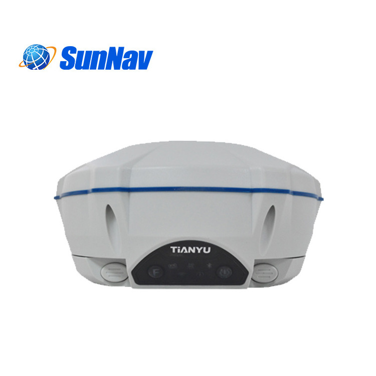
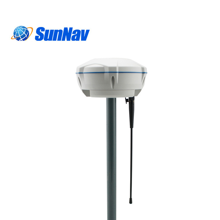
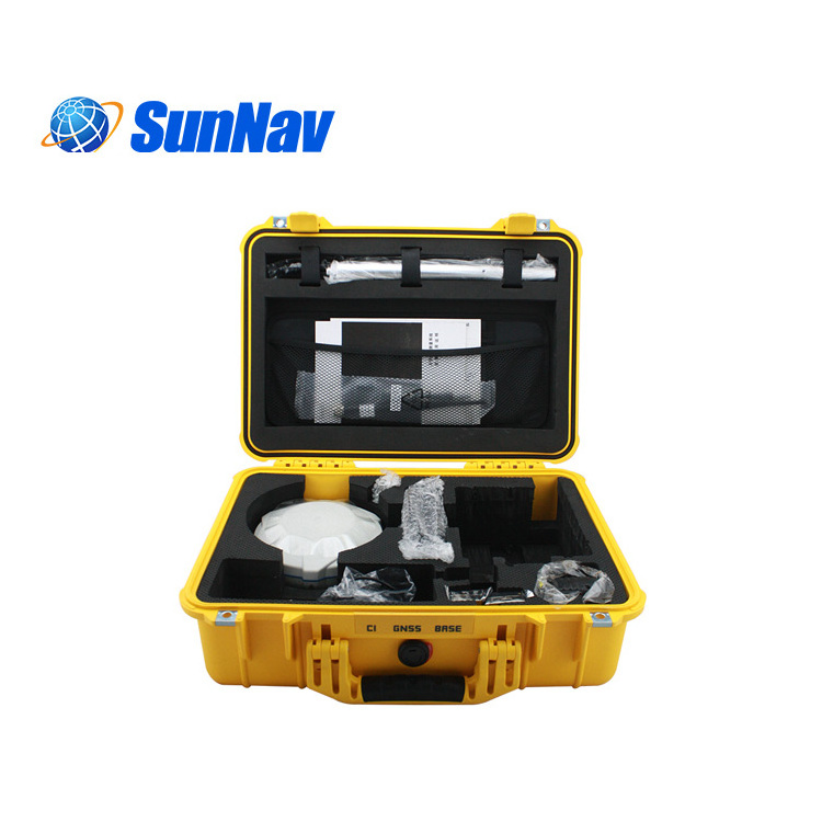
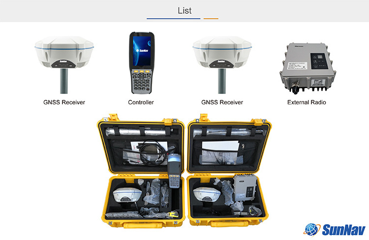
C1 GNSS RTK Receiver GPS Land Surveying Instrument

Description
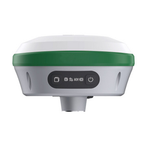
Adopting the latest embedded Linux operating system + intelligent cloud. The receiver will no longer be a stand-alone hardware device, but a complete intelligent system. With the powerful cloud service platform, you can remotely register, upgrade devices, remote services, remote diagnosis, you will enjoy a variety of remote services without leaving home. Classic symmetrical design, small and smart.
Leading technology with superior capabilities, C1 has tracked all GNSS Constellations: GPS, GLONASS, Galileo, BDS and SBAS.
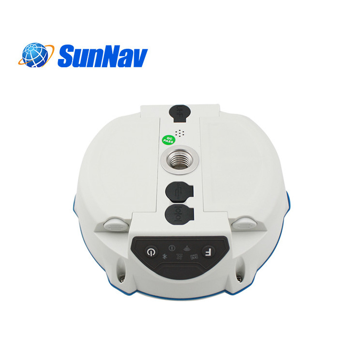
Dual batteries: Support hot plug, unlimited battery life. Integrated 4G network modem, Rx/Tx UHF module, EBubble, Bluetooth, NFC and WiFi connectivity provides seamless solution in field. All these features integrated into a small but ruggedized package allows the most productive day of surveying possible.
Features
• Full-featured radio: 410-470MHZ,support TrimTalk450S,TrimMark3,South
• High-speed network: 4G full Netcom module,compatible with 3G,2G,and support CORS system.
• Bluetooth data link: 100 meters limit connection
• WIFI data link
• Dual battery design,support hot swap,infinite battery life,providing strong protection for internal radio launch in base mode.Support
fast charging and external charging configurations.
• NFC touch
• Intelligent voice
• Electronic bubble
• WebUI
• Cloud Service:remotely manage and configure devices, and supports various functions such as viewing progress,managing jobs,
backing up data,real-time sharing,online upgrade,online registration,and so on.
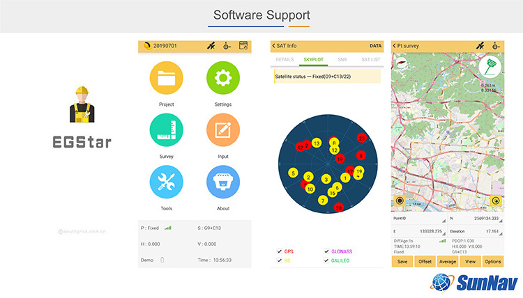
Engineering Star3.0 surveying software is the graphic software with simpleness, high efficiency and strong function. It provides the most usual function, such as detailing, stake-out point and stake-out line, with engineering and graphic interface.
It also has the added function of stake-out curved line, and stake-out road .
Not only does it use the characteristics of international comparable software for reference, such as convenient graphic display and precise structural module, it also combines the concrete specialty of the domestic fieldwork, making engineering star in the wake of international fashion and meet the needs of fieldwork as well.
Engineering Star3.0
also has many other features, such as flexible zoom graphic interface, tabular menu, which directly display critical task on the screen, abundant characteristics of fieldwork, complete edition, standard industrialized data output, coordinate collection, comprehensive RTK vector, GPS original and other data format.

|
|
specification |
||
|
Surveying performance |
Signal Tracking |
440 channels
BDS:B1,B2,B3
|
|
|
GNSS Features |
Positioning output rate 1Hz~50Hz Initialization time : <10s
Initialization reliability : >99.99%
|
||
|
Positioning Precision |
Code Differential GNSS Positioning |
Horizontal:0.25 m + 1 ppm RMS
|
|
|
Static GNSS Surveying |
±(2.5 mm + 0.5mm/km×d)
|
||
|
RTK Surveying |
±(8 mm + 1mm/km×d)
|
||
|
Operating system / user interaction |
Operating system |
Linux |
|
|
buttons |
Double key operation, convenient and quick |
||
|
indicator |
Five indicator lights |
||
|
Web interaction |
Built-in WebUI management background, support WiFi and USB mode access WebUI page, real-time monitoring of receiver status, set any configuration of the receiver. |
||
|
ivoice |
Intelligent ivoice technology, support for Chinese, English, Korean, Russian, Portuguese, Spanish, Turkish; support for voice customization |
||
|
Data cloud service |
Support register online, remote upgrade and etc. |
||
|
|
|
||
|
Physical |
Dimension |
175mm*83mm(Diameter, height) |
|
|
Weight |
1.06kg(without battery) |
||
|
material |
Thermoplastic polyester, polycarbonate polymer material |
||
|
temperature |
Operating:–30 °C to +65 °C
|
||
|
Humidity |
Resistance to 95% condensation |
||
|
Waterproof/ Dustproof |
Waterproof:1m immersion,IP67
|
||
|
shockproof |
Resistance to 2-meter drop with rod |
||
|
Electrical |
Power |
9-28V wide voltage DC design with overvoltage protection |
|
|
Power solution |
Dual battery power supply, hot plug support, power supply 6800mAh. |
||
|
Communications |
I/O Port 5PIN LEMO |
5 PIN LEMO External power interface +RS232
Radio, Network Antenna Interface (shared)
|
|
|
Radio modem |
Built-in high performance radio, (1W/ 2W/ 3W), typical operating distance 8km, operating frequency 410-470MHz, can switch to radio relay mode;
External radio: 5W/25W or 5w/35w
|
||
|
Cellular movement |
4G high-speed network communication module, compatible with 3G / GPRS / EDGE; compatible with various CORS system access. |
||
|
Bluetooth |
BLE Bluetooth 4.0, Bluetooth 2.1 +EDR standard |
||
|
NFC wireless communication |
Using NFC wireless communication technology, the controller can be automatically paired with the host receiver. |
||
|
WIFI |
standard |
802.11b/g/n |
|
|
WIFI hot spot |
WIFI hot spot function: intelligent terminal can connect to the receiver to do personalization custom; Data transmission between the receiver and the controller |
||
|
WIFI data chaining |
Receiver can access WIFI, to broadcast or receive differential data via WIFI |
||
|
Data storage / transmission |
Data storage |
8G solid state memory, supporting 32GB external extension, Automatic cyclic storage, Supporting external USB memory for data storage; |
|
|
transmission |
One key Smart copy directly exports host static data via external USB memory; plug and play USB for data transfer; FTP download, HTTP download |
||
|
data format |
Static: SOUTH,Rinex2.01,Rinex3.02
GPS output data format: NMEA 0183, PJK plane coordinates, binary code, Trimble GSOF; Network Mode support: VRS,FKP,MAC, supports NTRIP Protocol |
||
|
inertial navigation system / sensor |
Electron bubble |
Built-in sensors, data collector software can display electronic bubbles, real-time check the alignment of the surveying pole leveling situation |
|
|
temperature sensor |
real-time monitoring and adjusting host temperature |
||